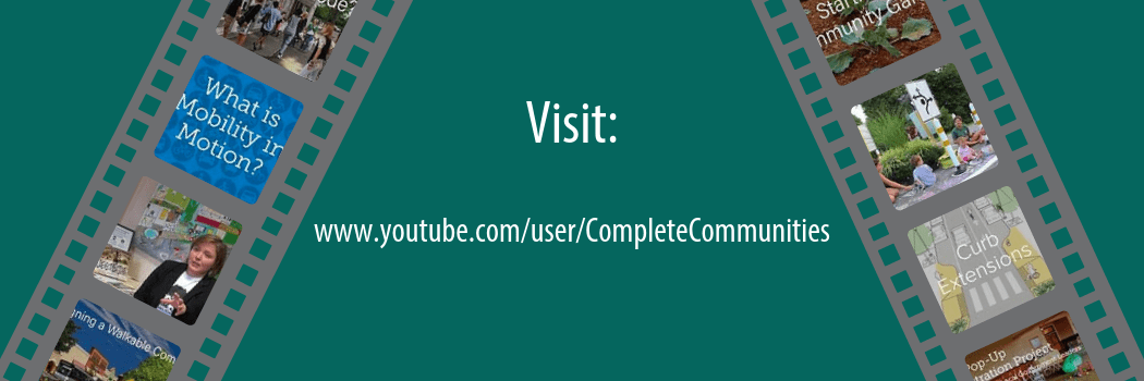
Explore the Complete Communities YouTube Channel for visually engaging tools to help you plan for communities that are attractive, inclusive, efficient, healthy, and resilient places. Check out our playlists for video series that feature interesting topics. Get to know creative placemakers in Delaware with the Stories of Delaware’s Complete Communities playlist that highlights innovative placemaking projects across Delaware. Watch the Delaware Byways playlist to take a journey through the scenic byways of Delaware’s natural landscape. New videos are posted frequently. From interviews with local experts to showcasing new policy strategies, the YouTube channel has something to offer for everyone interested in planning for complete communities.
Tag Archives: Planning
Delaware Complete Communities 2018 Year in Review Story Map
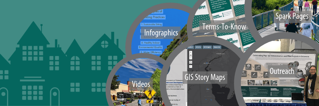
The Delaware Complete Communities Planning Toolbox project strives to provide local government officials, planning commission members, and “citizen planners” with the tools they need to create communities that are accessible, economically vibrant, healthy, inclusive, resilient, and livable for all residents. The Delaware Complete Communities 2018 GIS story map highlights initiatives undertaken in 2018 to support, develop, promote, and maintain the Delaware Complete Communities Planning Toolbox.
New Toolbox content, in the form of web pages, GIS Story Maps, Adobe Spark pages, videos, and infographics, is designed to foster an understanding of strategies to plan and design for complete communities in Delaware. New topics developed for the Toolbox with high-impact visual content are organized by the five elements of a complete community. Virtually meet the Delaware Complete Communities project team, view the project timeline, learn about the geography of our work, and experience the interactive content developed over the past year!
Wednesday’s Round-Up 1/24/18
Happy Wednesday! We’re trying out a new effort here on the Delaware Complete Communities Planning toolbox. Check in every two week for a round-up of new content added the toolbox, or discovered out in the interwebs, collected here just for you.
New this week
Tactical Urbanism is a strategy that uses quick, cheap projects to make a small part of the city more livable. This video highlights the benefits of this technique.
Are you ready for automated vehicles in Delaware? This video considers the impacts of autonomous and connected vehicles (CAVs) on issues such as roadway safety, traffic congestion, and the economy.
From the archives
Dust off our Winter Maintenance guide to review how Delaware local governments can clarify and better coordinate responsibilities for winter maintenance of pedestrian facilities.
Spotlight on Delaware
Gov. John Carney delivered his State of the State Address to a Joint Session of the General Assembly last week. Did you miss it? Watch it now.
Register now for upcoming training programs on land-use hosted by the Institute for Public Administration.
Have a suggestion for Fire Station no. 5 reuse? Wilmington is listening.
The next Sussex County Council Comprehensive Plan Workshop takes place on January 31, at 9:30 a.m.
Trending on the web
An unlikely hero for pedestrians… snow! How Heavy Snow Reveals Safer Street Designs. #SneckDown
Home AI devices like Alexa can ‘digest’ planning documents to share with homeowners.
Toronto Cleared Cars Off Its Biggest Transit Street, and Ridership Soared Almost Overnight.
IPA Presents Public Involvement Poster at 96th Annual TRB Meeting

Savannah Edwards and Marcia Scott present at the Transportation Research Board
IPA Policy Scientist Marcia Scott and Public Administration fellow Savannah Edwards (MPA ’17) presented a poster at the 96th Annual Meeting of the Transportation Research Board (TRB) in Washington, D.C. on January 9 and 10, 2017. TRB Session 697, “Current Issues in Transportation Public Involvement.” The poster, entitled “GIS Story Maps Empower and Engage Stakeholders in Planning for Complete Communities in Delaware,” was among the 25 selected for presentation by the TRB Committee on Public Involvement. The poster graphically displays how GIS Story Maps can engage planning stakeholders via both conventional, in-person methods (e.g., public meetings and workshops), and newer, high-tech strategies (e.g., accessing Apps from computers and mobile devices).
Designed by IPA Policy Specialist Sarah Pragg, the 4’ x 8’ poster summarizes research, funded by the Mid-Atlantic Transportation Sustainability University Transportation Center (MATS UTC), which explores the use of GIS Story Maps to satisfy mandates for increased transparency, accountability, and public engagement in planning for transportation-efficient and sustainable places. The final report, GIS Story Maps: A Tool to Empower and Engage Stakeholders in Planning Sustainable Places, is available electronically on IPA’s transportation policy publications webpage.
IPA has developed a series of GIS Story Maps to illustrate Delaware’s complete communities planning framework that is designed to build capacity of local governments to create “attractive, inclusive, efficient, healthy & resilient places.” Each Story Map conveys one of the five elements of a complete community. IPA’s poster is on display on the first floor or University of Delaware’s Graham Hall. IPA’s GIS Story Map Gallery can be viewed online at http://arcg.is/25DcjGV.
Upcoming Events in IPA’s Planning Education Training Program
Delaware’s municipalities are increasingly being asked to focus much of their attention on the state’s expected new growth and development. Municipalities must make difficult decisions that can have long-lasting impacts on the community’s character, economy, and quality.
The Delaware Planning Education Program is a voluntary certificate program comprising an organized series of educational courses designed to meet the responsibilities of municipalities as partners in planning Delaware’s future. The program is offered in partnership with the Office of State Planning Coordination and the Delaware Chapter of the American Planning Association.
Advanced Land-Use and Development Administration
“Planning 203” is a new hands-on course designed to provide participants with table-top exercises to build their skills for administering and interpreting land-use regulations.
March 24, 2017 | 9 a.m. to noon | University of Delaware Paradee Center | Dover, Del.
Cost: $50 | Instructors: Linda Raab, AICP, and Ann Marie Townshend, AICP
Register now | download workshop flyer | Registration deadline: March 23
Developing Your Strategy for Economic Development
Whether a formal report adopted by council or a back-of-the-envelope exercise worked out on-the-fly, an economic development strategy can work to guide municipal decision-making and encourage private investment in your community. “Planning 213” is a new session that advances concepts and principles for scoping, developing, and implementing your community’s economic development strategy.
April 28, 2017 | 9 a.m. to noon | University of Delaware Paradee Center | Dover, Del.
Cost: $50 | Instructors: Troy Mix, AICP; Maureen Feeney Roser; and Ann Marie Townshend, AICP
Register now | download workshop flyer | Registration deadline: April 27
Creating a Flood Ready Community
This popular course returns for the fourth year. “Planning 201” reviews the multiple sources of flood risks to Delaware communities that can be addressed and mitigated through planning, codes, and ordinances. It covers floodplain requirements for municipalities and tools for adapting to flood risk. Sources of funding and technical assistance will also be presented. Catered lunch and networking session will immediately follow the training, from noon–1 p.m.
May 19, 2017 | 9 a.m. to noon | University of Delaware Paradee Center | Dover, Del.
Cost: $50 | Instructors: Phil Barnes, PhD; Danielle Swallow; and Greg Williams
Register now | download workshop flyer | Registration deadline: May 18
A limited number of registration fee waivers are available for municipal officials, based on financial need. Fees will be covered by the Delaware Coastal Training Program. To request a fee waiver, please email Kelly Valencik, Coastal Training Program Coordinator at kelly.valencik@state.de.us.
Highlights from the Downtown Development Districts Program
Enacted by the Delaware General Assembly in 2014, the purposes of the Downtown Development Districts Act (the Act), are to:
- Spur private capital investments in commercial business districts and other neighborhoods;
- Stimulate job growth and improve the commercial vitality of districts and neighborhoods;
- Help build a stable community of long-term residents by improving housing opportunities; and,
- Assist municipalities in strengthening neighborhoods while harnessing the attraction that vibrant downtowns hold for talented people, innovative small businesses, and residents from all walks of life.
Local governments can take advantage of the program by identifying an area in their downtowns as being desirable for revitalization and then developing a district plan and incentives to support revitalization of the area in accordance with the goals of the Act. The application process for designation as a Downtown Development District (DDD or District) is facilitated by the Office of State Planning Coordination. The applications are then evaluated by the Cabinet Committee on State Planning Issues according to three criteria, as specified in the Act: the need and impact (50%), the quality of the district plan (30%), and the local incentives (20%). The Cabinet Committee then makes recommendations to the Governor who makes the final designation. According to the legislation, the number of districts is limited to 15 at any one time. So far, there are a total of eight designated Districts.
Three DDDs were designated in January 2015, including:
- City of Dover
- City of Seaford
- City of Wilmington
Three DDDs were designated in August 2016, including:
- Town of Georgetown
- City of Harrington
- Town of Laurel
- City of Milford
- City of Smyrna
For additional information on the DDD program, including District Plans and Maps for each of the designated Districts, please visit the Office of State Planning website.
Check out this GIS Story Map, which highlights the first year of the DDD program and benefits.
GIS Story Map and http://arcg.is/208FjmV
Benefits of Downtown Development Districts
The Downtown Development Districts Program seeks to revitalize the downtown “Central Business District” in selected city, town, and county areas through the use of economic incentives.
Downtown Development Districts aim to spur capital investments, stimulate job growth and improve commercial vitality, improve housing opportunities, and strengthen neighborhoods. The Delaware Annual Report on Downtown Development Districts is available on the Delaware State Housing Authority’s website.
Visit the Downtown Development Districts section of the toolbox to learn more about how these districts align with complete-community planning principles.
Story Map Development
This story map is produced as part of the Delaware Complete Communities Planning Toolbox with funding support from the Mid-Atlantic Transportation Sustainability Center-Region 3 University Transportation Center.
The story map was developed by Savannah Edwards, Public Administration Fellow, University of Delaware’s Institute for Public Administration (IPA) under the direction of IPA Policy Scientist Marcia Scott.
Special thanks to Connie Holland (Office of State Planning Coordination, OSPC), David Edgell (OSPC), Miriam Pomilio (OSPC), and Karen Horton (Delaware State Housing Authority) for featured content and assistance.
How to Utilize Story Maps in Your Community
Visit the GIS Story Maps section of the toolbox to learn more about how you can use this tool to promote local government initiatives to support market-ready (re)development in your community.
Contact IPA’s GIS Specialist Nicole Minni, at nminni@udel.edu, to obtain information on contracting her services to develop story maps.
GIS Story Map “Reimagines” Laurel
This GIS Story Map was developed for the Town of Laurel to highlight its outstanding redevelopment potential, location for small businesses, and quality of life. The GIS Story Map offers a variety of demographic and marketing data, points of interest, marketing research, and information about infrastructure and rates.
The story map is a project of the Sussex County Economic Development Action Committee (SEDAC), funded by the University of Delaware’s Sustainable Coastal Communities program. The maps and data are easy to upgrade and link to or embed on a town’s website. The map series was constructed by Nicole Minni, GISP, of the University of Delaware IPA and Lee Ann Walling, AICP, of Cedar Creek Sustainable Planners.
Visit the story maps section of the toolbox to learn more about how you can use this tool to promote local government initiatives to support market-ready (re)development in your community.
Contact IPA’s GIS Specialist Nicole Minni, at nminni@udel.edu, to obtain information on contracting her services to develop story maps.
How Walkable is Your Community?
Walkable, pedestrian infrastructure is a key element of a “Complete Community.” When sidewalks, parks, and trails are pleasant places to walk, all community members benefit. Unfortunately, not all places are walkable, but with the help of IPA’s Walkability Assessment Tool, citizens achieve positive changes.
Visit the Walkable Communities section of the toolbox to learn more about ways to improve pedestrian infrastructure. This section includes:
Newark Cycle Track: Pre-Engineering Assessment
IPA recently conducted a pre-engineering assessment study for a possible cycle track along Delaware Avenue in Newark. The assessment builds upon recommendations of the 2014 Newark Bicycle Plan, which was created by the Newark Bicycle Committee in collaboration with Newark city officials, residents, WILMAPCO, the Delaware Department of Transportation (DelDOT), and local advocacy organizations. According to the Plan, “one of the critical missing links to bicycling in downtown Newark is the lack of an adequate westbound bike route through the downtown. To provide for this missing link, it is recommended that Delaware Avenue be reconfigured to include a two-way, separated bike lane known as a cycle track.”
The Delaware Center for Transportation’s Winter 2015 TranSearch newsletter includes an article covering the Newark Cycle Track: Pre-Engineering Assessment and the process.
Watch the video
As part of the assessment, IPA public administration fellow Kirsten Jones (MA’16) prepared a video that shows her navigating as a cyclist and reacting to potential conflicts between motorized and non-motorized travelers along Delaware Avenue, between Orchard Road and the Newark High School.
New Guide to Transportation Improvement Districts
To help Delaware local governments better understand DelDOT regulations that govern the process to plan for and establish a TID, the Institute for Public Administration developed an electronic publication, Transportation Improvement Districts: A Guide for Delaware Local Governments.
Funded by the Delaware Department of Transportation (DelDOT), the guide discusses the purpose, benefits, and TID planning framework in Delaware.
It also provides a step-by-step process for Delaware local governments to follow to create TID(s) and two best-practice examples for planning (City of Newark) and implementation (City of Dover) of TIDs in Delaware.
The downloadable guide is part of a comprehensive set of online tools on TIDs within the Complete Streets element of Delaware Complete Communities Planning Toolbox, available here.