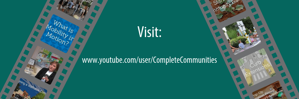
Explore the Complete Communities YouTube Channel for visually engaging tools to help you plan for communities that are attractive, inclusive, efficient, healthy, and resilient places. Check out our playlists for video series that feature interesting topics. Get to know creative placemakers in Delaware with the Stories of Delaware’s Complete Communities playlist that highlights innovative placemaking projects across Delaware. Watch the Delaware Byways playlist to take a journey through the scenic byways of Delaware’s natural landscape. New videos are posted frequently. From interviews with local experts to showcasing new policy strategies, the YouTube channel has something to offer for everyone interested in planning for complete communities.
Category Archives: Toolbox
May Is Bike Month
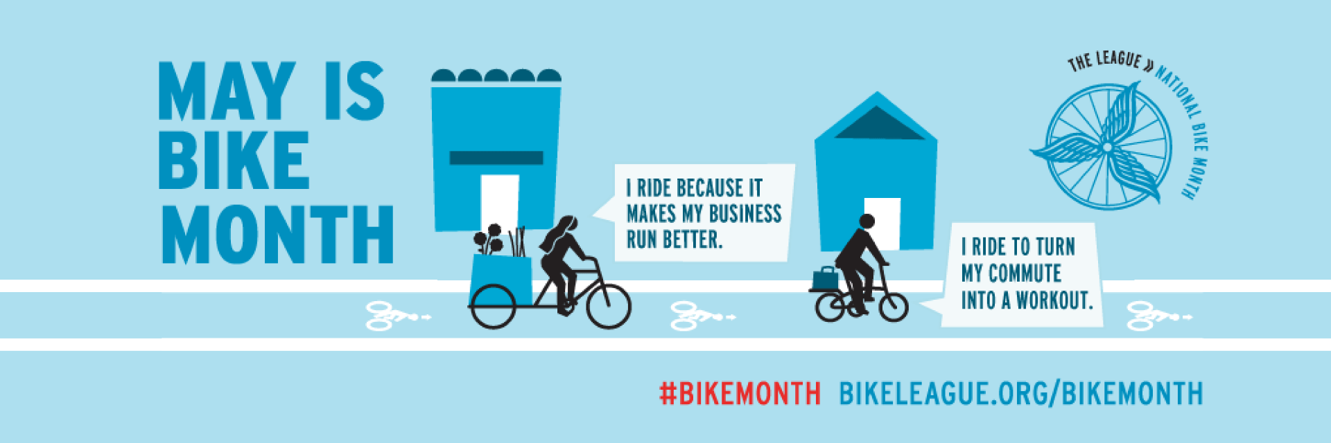
In celebration of Bike Month riders are coming together throughout the state to celebrate cycling. View this spark page for more information about events in your area.
IPA Presents Public Involvement Poster at 96th Annual TRB Meeting

Savannah Edwards and Marcia Scott present at the Transportation Research Board
IPA Policy Scientist Marcia Scott and Public Administration fellow Savannah Edwards (MPA ’17) presented a poster at the 96th Annual Meeting of the Transportation Research Board (TRB) in Washington, D.C. on January 9 and 10, 2017. TRB Session 697, “Current Issues in Transportation Public Involvement.” The poster, entitled “GIS Story Maps Empower and Engage Stakeholders in Planning for Complete Communities in Delaware,” was among the 25 selected for presentation by the TRB Committee on Public Involvement. The poster graphically displays how GIS Story Maps can engage planning stakeholders via both conventional, in-person methods (e.g., public meetings and workshops), and newer, high-tech strategies (e.g., accessing Apps from computers and mobile devices).
Designed by IPA Policy Specialist Sarah Pragg, the 4’ x 8’ poster summarizes research, funded by the Mid-Atlantic Transportation Sustainability University Transportation Center (MATS UTC), which explores the use of GIS Story Maps to satisfy mandates for increased transparency, accountability, and public engagement in planning for transportation-efficient and sustainable places. The final report, GIS Story Maps: A Tool to Empower and Engage Stakeholders in Planning Sustainable Places, is available electronically on IPA’s transportation policy publications webpage.
IPA has developed a series of GIS Story Maps to illustrate Delaware’s complete communities planning framework that is designed to build capacity of local governments to create “attractive, inclusive, efficient, healthy & resilient places.” Each Story Map conveys one of the five elements of a complete community. IPA’s poster is on display on the first floor or University of Delaware’s Graham Hall. IPA’s GIS Story Map Gallery can be viewed online at http://arcg.is/25DcjGV.
Upcoming Events in IPA’s Planning Education Training Program
Delaware’s municipalities are increasingly being asked to focus much of their attention on the state’s expected new growth and development. Municipalities must make difficult decisions that can have long-lasting impacts on the community’s character, economy, and quality.
The Delaware Planning Education Program is a voluntary certificate program comprising an organized series of educational courses designed to meet the responsibilities of municipalities as partners in planning Delaware’s future. The program is offered in partnership with the Office of State Planning Coordination and the Delaware Chapter of the American Planning Association.
Advanced Land-Use and Development Administration
“Planning 203” is a new hands-on course designed to provide participants with table-top exercises to build their skills for administering and interpreting land-use regulations.
March 24, 2017 | 9 a.m. to noon | University of Delaware Paradee Center | Dover, Del.
Cost: $50 | Instructors: Linda Raab, AICP, and Ann Marie Townshend, AICP
Register now | download workshop flyer | Registration deadline: March 23
Developing Your Strategy for Economic Development
Whether a formal report adopted by council or a back-of-the-envelope exercise worked out on-the-fly, an economic development strategy can work to guide municipal decision-making and encourage private investment in your community. “Planning 213” is a new session that advances concepts and principles for scoping, developing, and implementing your community’s economic development strategy.
April 28, 2017 | 9 a.m. to noon | University of Delaware Paradee Center | Dover, Del.
Cost: $50 | Instructors: Troy Mix, AICP; Maureen Feeney Roser; and Ann Marie Townshend, AICP
Register now | download workshop flyer | Registration deadline: April 27
Creating a Flood Ready Community
This popular course returns for the fourth year. “Planning 201” reviews the multiple sources of flood risks to Delaware communities that can be addressed and mitigated through planning, codes, and ordinances. It covers floodplain requirements for municipalities and tools for adapting to flood risk. Sources of funding and technical assistance will also be presented. Catered lunch and networking session will immediately follow the training, from noon–1 p.m.
May 19, 2017 | 9 a.m. to noon | University of Delaware Paradee Center | Dover, Del.
Cost: $50 | Instructors: Phil Barnes, PhD; Danielle Swallow; and Greg Williams
Register now | download workshop flyer | Registration deadline: May 18
A limited number of registration fee waivers are available for municipal officials, based on financial need. Fees will be covered by the Delaware Coastal Training Program. To request a fee waiver, please email Kelly Valencik, Coastal Training Program Coordinator at kelly.valencik@state.de.us.
Highlights from the Downtown Development Districts Program
Enacted by the Delaware General Assembly in 2014, the purposes of the Downtown Development Districts Act (the Act), are to:
- Spur private capital investments in commercial business districts and other neighborhoods;
- Stimulate job growth and improve the commercial vitality of districts and neighborhoods;
- Help build a stable community of long-term residents by improving housing opportunities; and,
- Assist municipalities in strengthening neighborhoods while harnessing the attraction that vibrant downtowns hold for talented people, innovative small businesses, and residents from all walks of life.
Local governments can take advantage of the program by identifying an area in their downtowns as being desirable for revitalization and then developing a district plan and incentives to support revitalization of the area in accordance with the goals of the Act. The application process for designation as a Downtown Development District (DDD or District) is facilitated by the Office of State Planning Coordination. The applications are then evaluated by the Cabinet Committee on State Planning Issues according to three criteria, as specified in the Act: the need and impact (50%), the quality of the district plan (30%), and the local incentives (20%). The Cabinet Committee then makes recommendations to the Governor who makes the final designation. According to the legislation, the number of districts is limited to 15 at any one time. So far, there are a total of eight designated Districts.
Three DDDs were designated in January 2015, including:
- City of Dover
- City of Seaford
- City of Wilmington
Three DDDs were designated in August 2016, including:
- Town of Georgetown
- City of Harrington
- Town of Laurel
- City of Milford
- City of Smyrna
For additional information on the DDD program, including District Plans and Maps for each of the designated Districts, please visit the Office of State Planning website.
Check out this GIS Story Map, which highlights the first year of the DDD program and benefits.
GIS Story Map and http://arcg.is/208FjmV
Benefits of Downtown Development Districts
The Downtown Development Districts Program seeks to revitalize the downtown “Central Business District” in selected city, town, and county areas through the use of economic incentives.
Downtown Development Districts aim to spur capital investments, stimulate job growth and improve commercial vitality, improve housing opportunities, and strengthen neighborhoods. The Delaware Annual Report on Downtown Development Districts is available on the Delaware State Housing Authority’s website.
Visit the Downtown Development Districts section of the toolbox to learn more about how these districts align with complete-community planning principles.
Story Map Development
This story map is produced as part of the Delaware Complete Communities Planning Toolbox with funding support from the Mid-Atlantic Transportation Sustainability Center-Region 3 University Transportation Center.
The story map was developed by Savannah Edwards, Public Administration Fellow, University of Delaware’s Institute for Public Administration (IPA) under the direction of IPA Policy Scientist Marcia Scott.
Special thanks to Connie Holland (Office of State Planning Coordination, OSPC), David Edgell (OSPC), Miriam Pomilio (OSPC), and Karen Horton (Delaware State Housing Authority) for featured content and assistance.
How to Utilize Story Maps in Your Community
Visit the GIS Story Maps section of the toolbox to learn more about how you can use this tool to promote local government initiatives to support market-ready (re)development in your community.
Contact IPA’s GIS Specialist Nicole Minni, at nminni@udel.edu, to obtain information on contracting her services to develop story maps.
Creating ADA-Accessible Communities
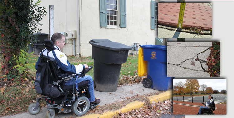
This video, entitled Creating ADA-Accessible Communities, highlights Americans with Disabilities Act (ADA) accessibility issues within pedestrian environments. The video features DelDOT ADA Title II Coordinator John McNeal using a Go-Pro camera to record, from his perspective, common ADA challenges navigating pedestrian facilities in an urban setting.
Under ADA Title II, public entities (including state and local governments) are required to ensure accessible design, construction, and maintenance of all transportation projects—including pedestrian facilities. Pedestrian facilities include public sidewalks, shared-use paths, curb ramps, crosswalks, pedestrian islands, pedestrian signals, transit stops, and other pedestrian features within the public right-of-way. However, persons with disabilities often face accessibility barriers caused by physical obstructions, improper design, or insufficient maintenance of pedestrian infrastructure.
Jurisdictions must address these issues to ensure that access for persons with disabilities is provided wherever a pedestrian facility is newly built or altered. To comply with ADA, the same degree of convenience, connection, and safety afforded the public must also be available to pedestrians with disabilities. Ultimately, pedestrian facilities must be readily accessible to and usable by persons with disabilities.
Highlights from the Downtown Development Districts Program
On June 27, Governor Jack Markell and the Delaware State Housing Authority announced that Wilmington, Dover, and Seaford will receive $4.5 million in grant funding for 11 downtown revitalization projects at part of Delaware’s Downtown Development Districts program.
Check out this GIS Story Map, which highlights the history and success of the program thus far.
Benefits of Downtown Development Districts
The Downtown Development Districts Program seeks to revitalize the downtown “Central Business District” in selected city, town, and county areas through the use of economic incentives.
Downtown Development Districts aim to spur capital investments, stimulate job growth and improve commercial vitality, improve housing opportunities, and strengthen neighborhoods. The Delaware Annual Report on Downtown Development Districts is available on the Delaware State Housing Authority’s website.
Visit the Downtown Development Districts section of the toolbox to learn more about how these districts align with complete-community planning principles.
Story Map Development
This story map is produced as part of the Delaware Complete Communities Planning Toolbox with funding support from the Mid-Atlantic Transportation Sustainability Center-Region 3 University Transportation Center.
The story map was developed by Savannah Edwards, Public Administration Fellow, University of Delaware’s Institute for Public Administration (IPA) under the direction of IPA Policy Scientist Marcia Scott.
Special thanks to Connie Holland (Office of State Planning Coordination, OSPC), David Edgell (OSPC), Miriam Pomilio (OSPC), and Karen Horton (Delaware State Housing Authority) for featured content and assistance.
How to Utilize Story Maps in Your Community
Visit the GIS Story Maps section of the toolbox to learn more about how you can use this tool to promote local government initiatives to support market-ready (re)development in your community.
Contact IPA’s GIS Specialist Nicole Minni, at nminni@udel.edu, to obtain information on contracting her services to develop story maps.
Searchable List of Funding Resources for Community Resiliency
The Institute for Public Administration (IPA) at the University of Delaware, with support from Delaware Coastal Programs, conducted an extensive search of financial assistance programs that support the implementation of resiliency-building plans and projects in Delaware and compiled the findings into an accessible and intuitive online searchable database. While planning and technical assistance programs were identified and included, IPA’s search prioritized financial assistance programs that support the implementation of high-cost activities such as infrastructure improvements, facility retrofitting, construction, and land acquisition.
Use the sorting feature to quickly and easily filter programs by four categories:
- Type of assistance offered (grant, loan, etc.)
- Project scope (land acquisition, energy efficiency retrofits, etc.)
- Amount of financial assistance available
- Whether or not matching funds are required
After making these selections, a list of search results will appear. Then click on the program title to reveal more in-depth information.
Visit www.sppa.udel.edu/research-public-service/ddfrc to utilize the database.
“States throughout [the Mid-Atlantic region] should view this effort in Delaware as a best practice and look for opportunities to form partnerships and compile resources for resiliency projects that are specific for their states,” officials from the Federal Emergency Management Agency (FEMA) said in their winter 2017 resilience report on innovative strategies to improve community resiliency for the Mid-Atlantic region.
“Navigating the abundance of grant programs can be challenging, and many communities may be unaware of every program available to them,” wrote FEMA in the report. “This user-friendly web tool inventories resources that support resilient community development, including funding programs for disaster preparedness, disaster recovery, education, planning, property acquisition, stormwater management, and storm-proofing projects.”
This project was prepared for the Delaware Coastal Management Program using federal funds under award NA14NOS4190123 from the National Oceanic and Atmospheric Administration (NOAA), U.S. Department of Commerce (DOC). The statements, findings, conclusions, and recommendations are those of the author(s) and do not necessarily reflect the views of the NOAA or the DOC.
How bikeable is your community?
Use the newly developed Low-Stress Bicycling Assessment Tool to find out!
Planning for Complete Communities in Delaware: The Low-Stress Bikeability Assessment Tool is a resource for Delaware local governments that are considering ways to improve the low-stress bikeability for areas within their community. It is designed to guide local governments in evaluating the extent to which average bicycle riders can easily access low-stress areas, and in developing strategies to leverage state investments to improve local cycling networks and bicycle infrastructure. The Low-Stress Bicycling Assessment Tool should be used in combination with DelDOT’s maps to help communities target high-priority locations to plan for infrastructure improvements, bridge network connectivity gaps, and enhance low-stress conditions for the average bicyclist.
Three Steps Toward a Flood-Ready Community
Delaware Local Government Planning Framework: Flood-Ready Communities
Resilient communities leverage the strengths and capacities of individuals, families, businesses, schools, and hospitals to “bounce back” after flood events, rather than merely react to impacts.
The new “Flood-Ready Communities” section of the Toolbox provides for a planning framework to equip Delaware communities with the tools necessary to transform communities into flood-ready, resilient places.
This topic area highlights a process and tools for Delaware communities to evaluate risks, plan to adapt, and execute actions to address the impacts of flooding.
This section also features a GIS StoryMap showcasing “freeboard” as a tool to achieve a sustainable and resilient community. When adopted as part of a floodplain management strategy, freeboard can create flood-ready communities that are prepared to protect and preserve properties and lives.
Visit the new “Flood-Ready Communities” section of the Toolbox today!