GLOSSARY OF TERMS
Definitions
Glossary of Policy & Planning Terms
Explore our glossary for definitions of key policy and planning terms for building a complete community. These explanations will help you work towards to a complete community in your town.
A - Terms
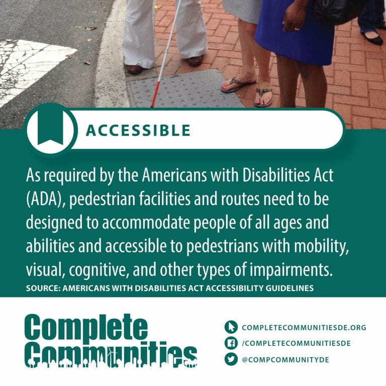
Accessible – Easily used or accessed by people with disabilities; adapted for use by people with disabilities
Active Transportation – Active transportation is self-propelled motion or getting around using human power, whether you are walking, cycling, jogging, skateboarding, inline skating or traveling in a non-mechanized wheelchair.
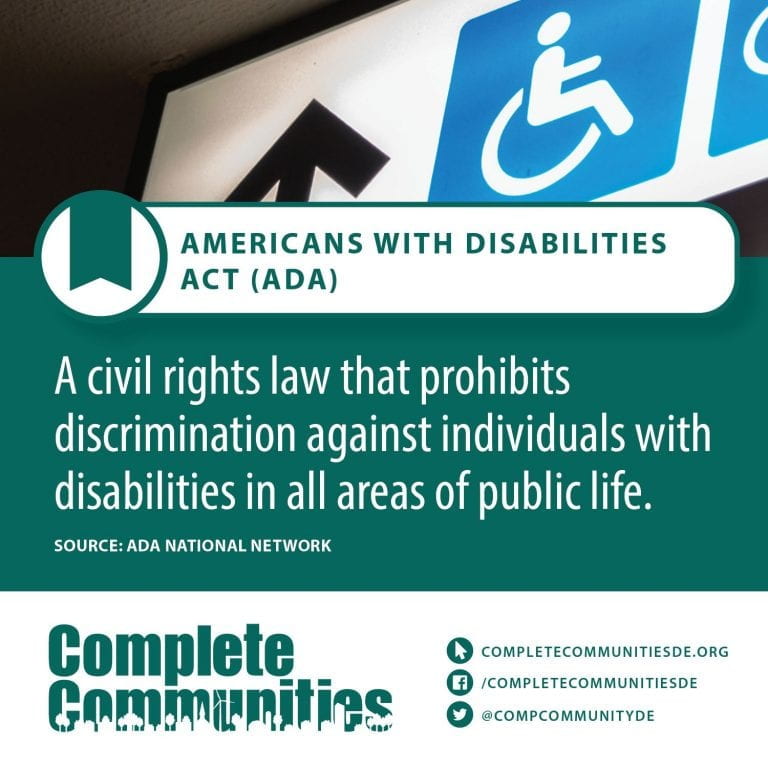
Americans with Disabilities Act – The Americans with Disabilities Act of 1990 or ADA (42 U.S.C. § 12101) is a civil rights law that prohibits discrimination based on disability. It affords similar protections against discrimination to Americans with disabilities as the Civil Rights Act of 1964, which made discrimination based on race, religion, sex, national origin, and other characteristics illegal, and later sexual orientation and gender identity. In addition, unlike the Civil Rights Act, the ADA also requires covered employers to provide reasonable accommodations to employees with disabilities, and imposes accessibility requirements on public accommodations.
In 1986, the National Council on Disability had recommended the enactment of an Americans with Disabilities Act (ADA) and drafted the first version of the bill which was introduced in the House and Senate in 1988. The final version of the bill was signed into law on July 26, 1990, by President George H. W. Bush. It was later amended in 2008 and signed by President George W. Bush with changes effective as of January 1, 2009.
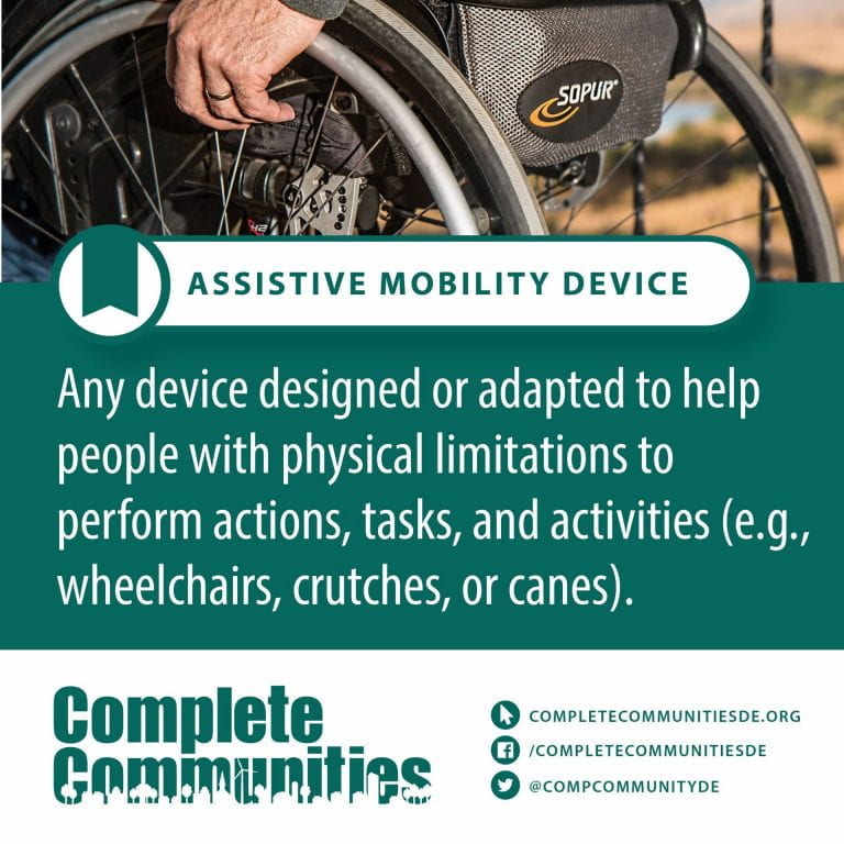
Assistive Mobility Device – Assistive technologies and adaptive devices are either physical equipment or digital tools that help adults and children with physical, intellectual, speech, hearing, and/or vision impairments to participate in activities, perform tasks, be more active, and live a more independent and functional life.
B - Terms
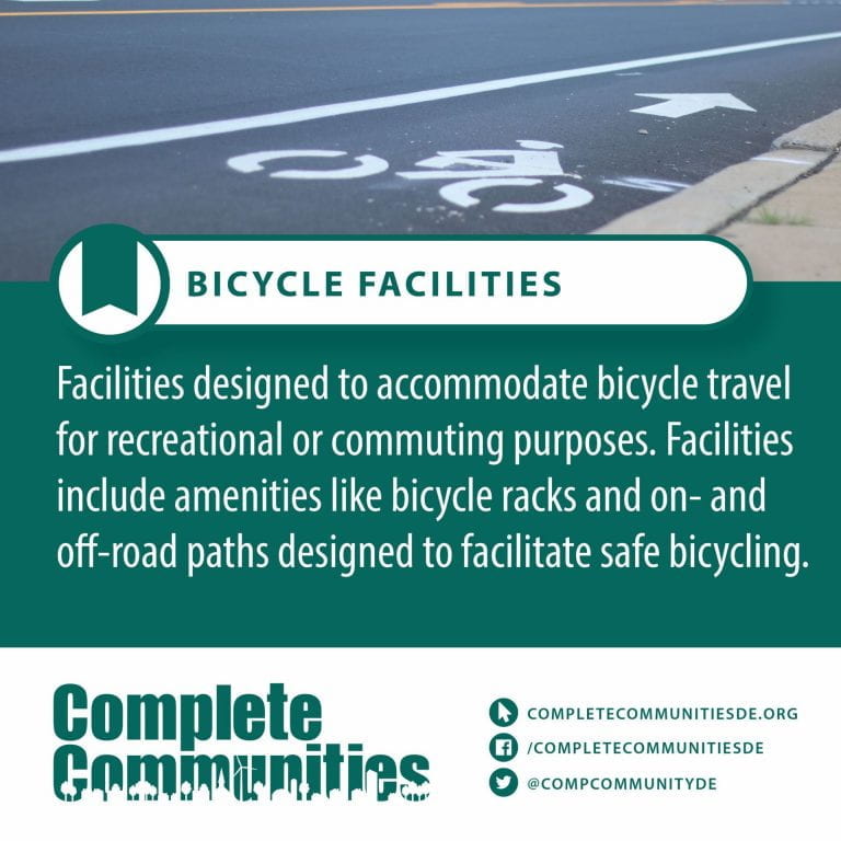
Bicycle Facilities – Cycling infrastructure refers to all infrastructure permissible for use by cyclists, including the network of roads and streets used by motorists, except where cyclists are excluded (e.g., many freeways/motorways), along with bikeways from which motor vehicles are excluded – including bike paths, bike lanes, cycle tracks, rail trails and, where permitted, sidewalks. Cycling infrastructure also includes amenities such as bike racks for parking, shelters, service centers and specialized traffic signs and signals. Cycling modal share is strongly associated with the size of local cycling infrastructure.
This fietspad (bicycle path) is in the Netherlands safely linking housing with decent street lights.
The manner in which the public road network is designed, built and managed can have a significant effect on the utility and safety of cycling. The cycling network may be able to provide the users with direct, convenient routes minimizing unnecessary delay and effort in reaching their destinations. Settlements with a dense road network of interconnected streets tend to be viable utility cycling environments.
C - Terms
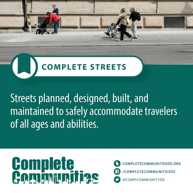
Complete Streets – Complete streets is a transportation policy and design approach that requires streets to be planned, designed, operated and maintained to enable safe, convenient and comfortable travel and access for users of all ages and abilities regardless of their mode of transportation. Complete Streets allow for safe travel by those walking, cycling, driving automobiles, riding public transportation, or delivering goods.
The term is often used by transportation advocates, urban planners, traffic and highway engineers, public health practitioners, and community members in the United States and Canada. Complete Streets are promoted as offering improved safety, health, economic, and environmental outcomes. Complete Streets emphasize the importance of safe access for all users, not just automobiles.
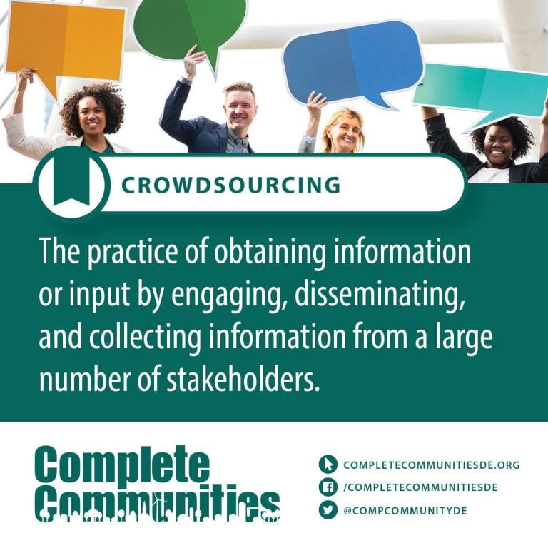
Community Engagement – Community engagement is involvement and participation in an organization for the welfare of the community.
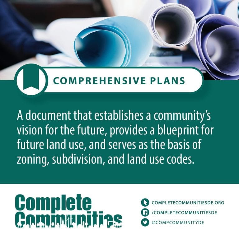
</a Comprehensive plan – Comprehensive planning is an ordered process that determines community goals and aspirations in terms of community development. The end product is called a comprehensive plan, also known as a general plan, or master plan. This resulting document expresses and regulates public policies on transportation, utilities, land use, recreation, and housing. Comprehensive plans typically encompass large geographical areas, a broad range of topics, and cover a long-term time horizon. The term comprehensive plan is most often used by urban planners in the United States.
Each city and county adopts and updates their plan to guide the growth and land development of their community, for both the current period and the long term. This “serious document” is then the foundation for establishing goals, purposes, zoning and activities allowed on each land parcel to provide compatibility and continuity to the entire region as well as each individual neighborhood. It has been one of the most important instruments in city and regional planning since the early twentieth century.
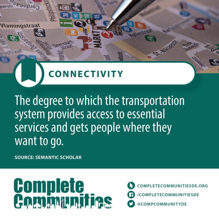
Connectivity – The quality, state, or capability of being connective or connected
Cotinine – Cotinine is an alkaloid found in tobacco and is also the predominant metabolite of nicotine. An anagram of the word “nicotine”, it is used as a biomarker for exposure to tobacco smoke. Cotinine is currently being studied as a treatment for depression, PTSD, schizophrenia, Alzheimer’s disease and Parkinson’s disease. Cotinine was developed as an antidepressant as a fumaric acid salt, cotinine fumarate, to be sold under the brand name Scotine but it was never marketed.
Similarly to nicotine, cotinine binds to, activates, and desensitizes neuronal nicotinic acetylcholine receptors, though at much lower potency in comparison. It has demonstrated nootropic and antipsychotic-like effects in animal models. Cotinine treatment has also been shown to reduce depression, anxiety, and fear-related behavior as well as memory impairment in animal models of depression, PTSD, and Alzheimer’s disease. Nonetheless, treatment with cotinine in humans was reported to have no significant physiologic, subjective, or performance effects in one study, though others suggest that this may not be the case.
Because cotinine is the main metabolite to nicotine and has been shown to be pharmacologically active, it has been suggested that some of nicotine’s effects in the nervous system may be mediated by cotinine and/or complex interactions with nicotine itself.
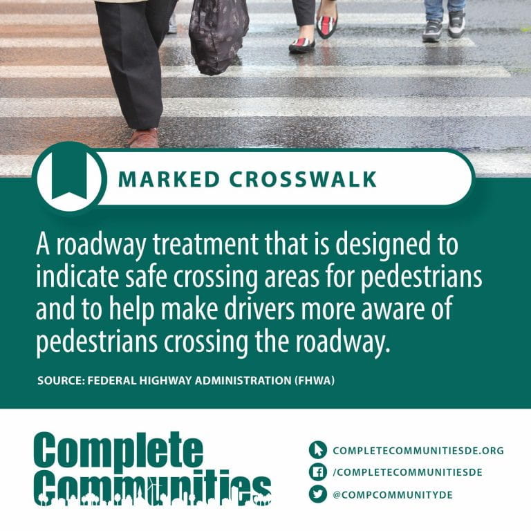
Crosswalk – A pedestrian crossing or crosswalk is a place designated for pedestrians to cross a road, street or avenue. The term “pedestrian crossing” is also used in the Vienna and Geneva Conventions, both of which pertain to road signs and road traffic.
Marked pedestrian crossings are often found at intersections, but may also be at other points on busy roads that would otherwise be too unsafe to cross without assistance due to vehicle numbers, speed or road widths. They are also commonly installed where large numbers of pedestrians are attempting to cross (such as in shopping areas) or where vulnerable road users (such as school children) regularly cross. Rules govern usage of the pedestrian crossings to ensure safety; for example, in some areas, the pedestrian must be more than halfway across the crosswalk before the driver proceeds.
Signalized pedestrian crossings clearly separate when each type of traffic (pedestrians or road vehicles) can use the crossing. Unsignalised crossings generally assist pedestrians, and usually prioritize pedestrians, depending on the locality. Pelican crosswalks use signals to keep pedestrians together where they can be seen by motorists, and where they can cross most safely across the flow of vehicular traffic, whereas zebra crossings are uncontrolled and more appropriate for lower people flows. What appears to be just pedestrian crossings can also be created largely as a traffic calming technique, especially when combined with other features like pedestrian priority, refuge islands, or raised surfaces.
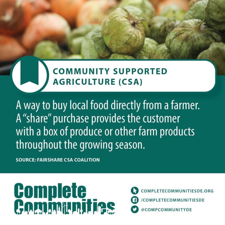
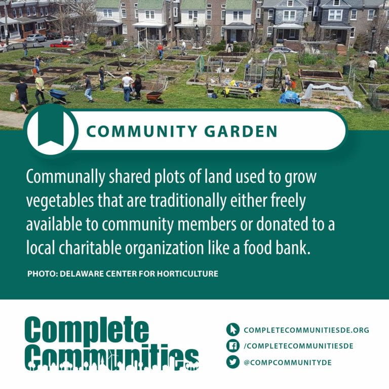
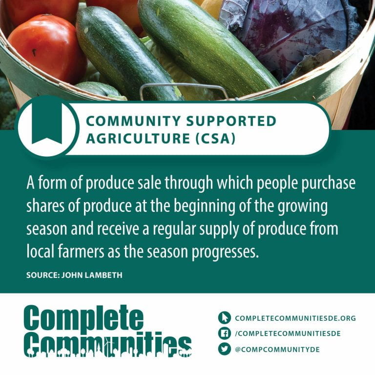
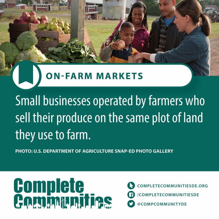
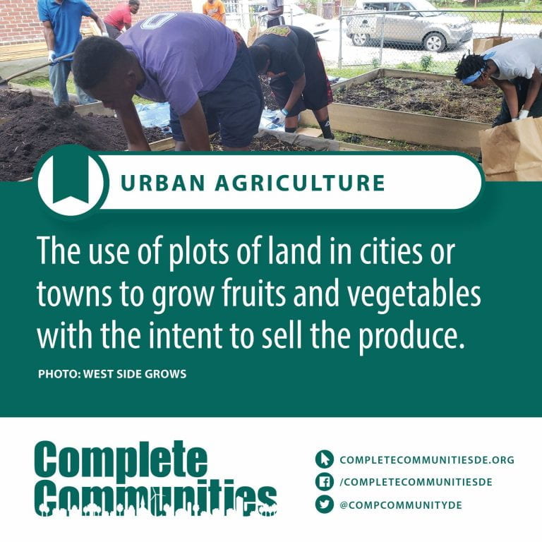
“Cyber-crop” and “Cyber-shop” programs – Delaware recently became the third state to launch “cyber-crop” and “cyber-shop” programs. These websites are modeled after projects developed by the Environmental Finance Center at the University of Maryland’s National Center for Smart Growth Research and Education. Economically, these programs are beneficial both to farmers and consumers alike, because consumers are able to purchase local, seasonal produce while helping farmers better understand its supply and demand.
Cultural Resources – In the broadest sense, cultural resource management (CRM) is the vocation and practice of managing heritage assets, and other cultural resources such as contemporary art. It incorporates Cultural Heritage Management which is concerned with traditional and historic culture. It also delves into the material culture of archaeology. Cultural resource management encompasses current culture, including progressive and innovative culture, such as urban culture, rather than simply preserving and presenting traditional forms of culture.
However, the broad usage of the term is relatively recent and as a result it is most often used as synonymous with heritage management. In the United States, cultural resources management is not usually divorced from the heritage context. The term is, “used mostly by archaeologists and much more occasionally by architectural historians and historical architects, to refer to managing historic places of archaeological, architectural, and historical interests and considering such places in compliance with environmental and historic preservation laws.” Cultural resources include both physical assets such as archaeology, architecture, paintings and sculptures and also intangible culture such as folklore and interpretative arts, such as storytelling and drama. Cultural resource managers are typically in charge of museums, galleries, theaters etc., especially those that emphasize culture specific to the local region or ethnic group. Cultural tourism is a significant sector of the tourism industry.
At a national and international level, cultural resource management may be concerned with larger themes, such as languages in danger of extinction, public education, the ethos or operation of multiculturalism, and promoting access to cultural resources. The Masterpieces of the Oral and Intangible Heritage of Humanity is an attempt by the United Nations to identify examples of intangible culture.
D - Terms
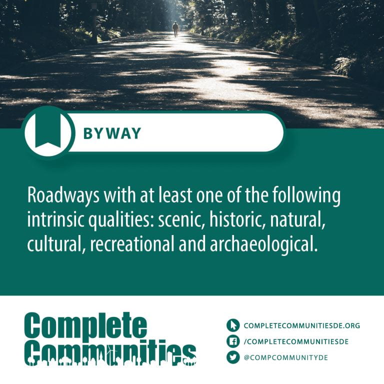
Delaware Byways – The Delaware Byways (formerly Delaware Scenic and Historic Highways) system consists of roads in the U.S. state of Delaware that travel through areas of scenic and historic interest. The intent of this system is to promote tourism and raise awareness of the communities along these routes.
Delaware Database for Funding Resilient Communities – The Institute for Public Administration (IPA) at the University of Delaware, with support from Delaware Coastal Programs, conducted an extensive search of financial assistance programs that support the implementation of resiliency-building plans and projects in Delaware and compiled the findings into an accessible and intuitive online searchable database.
While planning and technical assistance programs were identified and included, IPAs search prioritized financial assistance programs that support the implementation of high-cost activities such as infrastructure improvements, facility retrofitting, construction, and land acquisition.
Delaware Strategies for State Policies and Spending – Delaware’s Strategies for State Policies and Spending are used to coordinate state agency planning, resource management, and investments in order to support growth where it is appropriate and planned for, and discourage growth in inappropriate locations. These positive, proactive strategies seek to curb sprawl and direct growth to areas where the state, counties and local governments are most prepared in terms of infrastructure investment and thoughtful planning.
Demographics – Demographic analysis is the study of a population-based on factors such as age, race, and sex. Demographic data refers to socioeconomic information expressed statistically, including employment, education, income, marriage rates, birth and death rates, and more.
Governments, corporations, and non-government organizations use demographics to learn more about a population’s characteristics for many purposes, including policy development and economic market research.
For example, a company that sells high-end RVs may want to reach people nearing or at retirement age and the percentage of those who can afford their products.
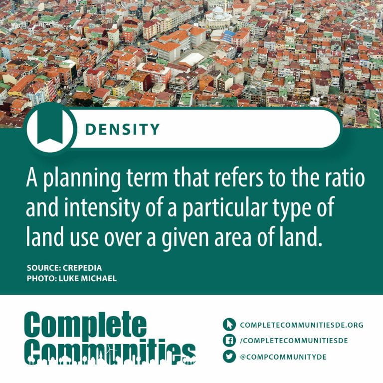
Density/Compact Development – Compact Development means a land use and design concept which promotes relatively high residential development with mixed land uses and based on an efficient public transport system and has an urban layout which encourages active transportation, low energy consumption and reduced pollution.
Disabled – impaired or limited by a physical, mental, cognitive, or developmental condition : affected by disability
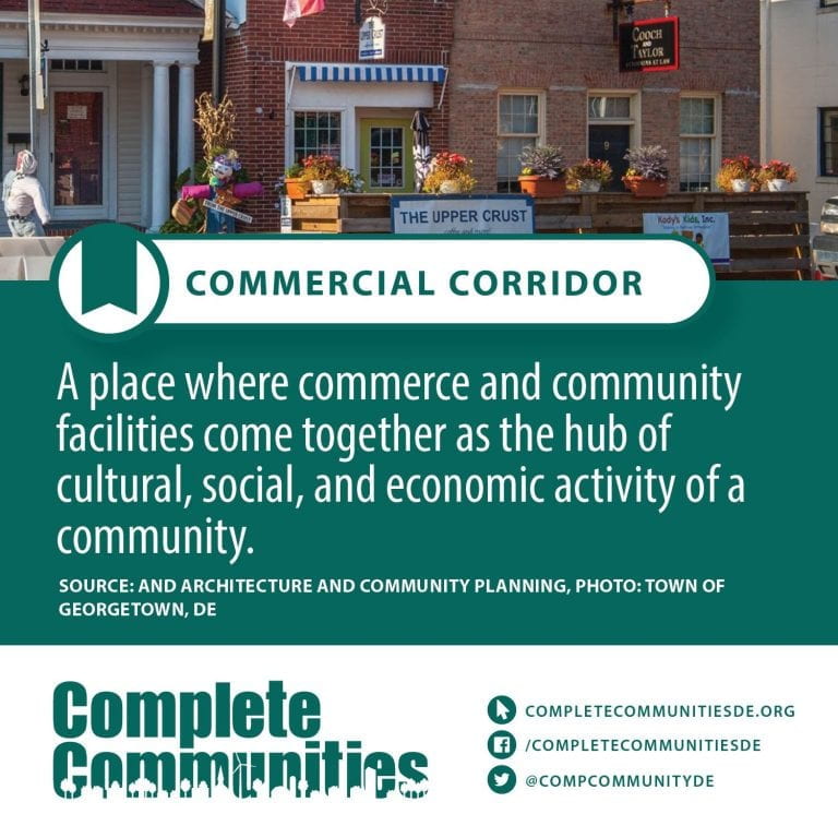
Downtown – Downtown is a term primarily used in North America by English speakers to refer to a city’s sometimes commercial, cultural and often the historical, political and geographic heart. It is often synonymous with its central business district (CBD). Downtowns typically contain a small percentage of a city’s employment. In some metropolitan areas it is marked by a cluster of tall buildings, cultural institutions and the convergence of rail transit and bus lines. In British English, the term “city center” is most often used instead.
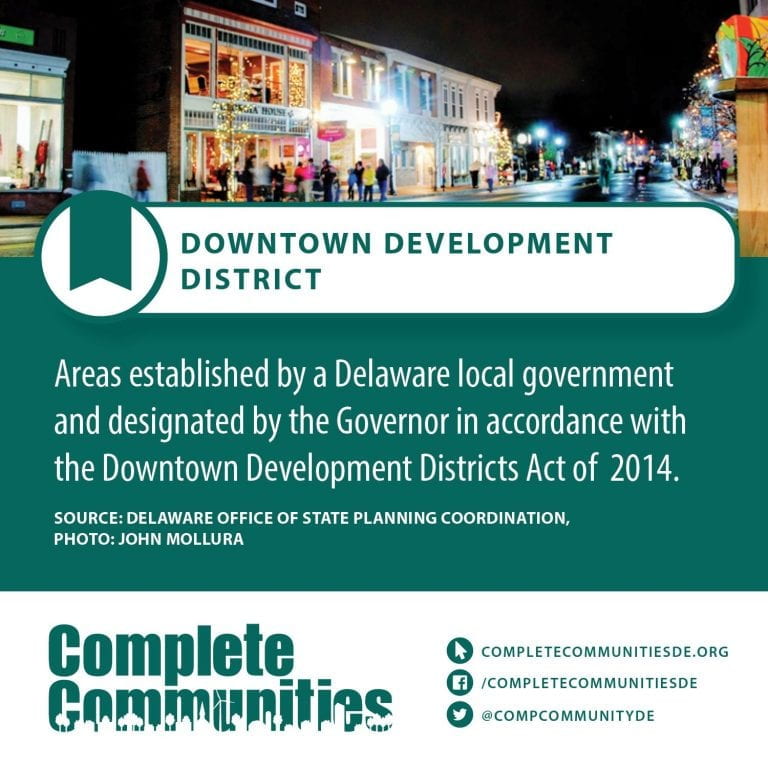
Downtown Development Districts – Downtown Development District or “DDD” means an area within a municipality or unincorporated area designated by the governor as a Downtown Development District under 79 Del. Laws c. 240.
Downtown Development Plans – A downtown plan is the hallmark of a community that is looking to clearly define its path towards revitalization. A traditional downtown plan outlines recommendations, where they will be implemented, and how much they will cost. These plans are a fantastic way to solidify the goals of your community, yet they lack the necessary thought and planning to ensure recommendations are implementable. This step often falls to a strategic plan, by which time many communities have become apathetic about the planning process. At that point, many communities flounder and become disenfranchised with the downtown revitalization process.
With this understanding of the process, the logical solution is to create a document that is a hybrid of a traditional downtown plan and a strategic plan. Selecting the best parts of each and combining them into a single, more direct document will help a community more easily and seamlessly move into implementation. Keep reading to learn about some practical ways to create a strategic downtown plan that will help bring about changes in your downtown, build on easily completed projects, and grow momentum to meet objectives.
E - Terms
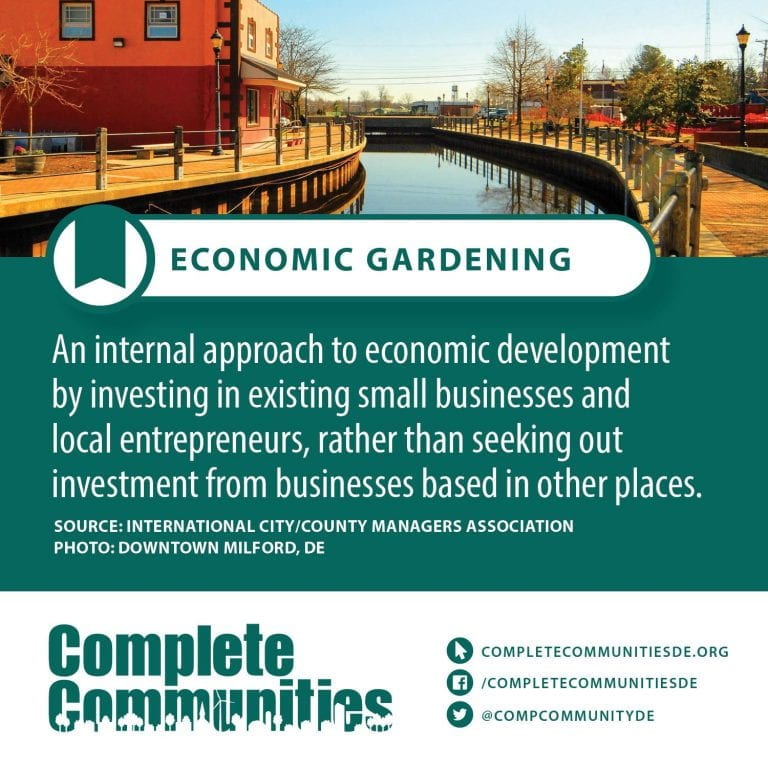
Economic Development – In the economics study of the public sector, economic and social development is the process by which the economic well-being and quality of life of a nation, region, local community, or an individual are improved according to targeted goals and objectives.
The term has been used frequently in the 20th and 21st centuries, but the concept has existed in the West for far longer. “Industrialization” is another term that is often used while discussing economic development. The monitoring of economic activities is of great significance for understanding regional economic development level and policymaking. As the carrier of economic activities, land resource is an indispensable production factor of economic development, and economic growth leads to increased demand for land as well as changes in land utilization form. As an important means of earth observation, remote-sensing technology can obtain the information of land use and land cover change (LUCC) related to economic activities.
Whereas economic development is a policy intervention aiming to improve the well-being of people, economic growth is a phenomenon of market productivity and increases in GDP; economist Amartya Sen describes economic growth as but “one aspect of the process of economic development”. Economists primarily focus on the growth aspect and the economy at large, whereas researchers of community economic development concern themselves with socioeconomic development as well.
Efficient Land Use – Efficient land use provides a mix of complementary land uses, supports compact building design, and strengthens and revitalizes downtown commercial areas and “Main Streets.”
Environmental sustainability – Sustainability is a societal goal with three dimensions (also called pillars): the environmental, economic and social dimension. This concept can be used to guide decisions at the global, national and at the individual consumer level. A related concept is that of sustainable development. Both terms are often used synonymously. UNESCO formulated a distinction as follows: “Sustainability is often thought of as a long-term goal (i.e. a more sustainable world), while sustainable development refers to the many processes and pathways to achieve it.”
For many people, especially those from the environmental movement, sustainability is closely linked with environmental issues. This is also called “environmental sustainability”, and is explained with the “planetary boundaries” model. The public is concerned about human impacts on the environment. The most dominant environmental issues since about the year 2000 have been climate change, loss of biodiversity and environmental pollution and land degradation (such as deforestation and general degradation of ecosystems).
The economic dimension of sustainability is as controversial as the concept of sustainability itself. This is partly because of the inherent contradictions between “welfare for all” and environmental conservation. To resolve this contradiction, the decoupling of economic growth from environmental deterioration needs to be considered. It is difficult to achieve because environmental and social costs are not generally paid by the entity that causes them, and are not expressed in the market price. Usually, externalities are either not addressed at all or are left to be addressed by government policy or by local governance. Some examples are: taxing the activity (the polluter pays); subsidizing activities that have a positive environmental or social effect (rewarding stewardship); or outlawing the practice (legal limits on pollution).
The social dimension of sustainability is the least defined and least understood dimension of sustainability. Some academics have proposed more dimensions of sustainability such as institutional, cultural, and technical dimensions.
The concept of sustainability has been criticized from different angles. One angle is that sustainability as a goal might be impossible to reach due to far-reaching detrimental impacts of humans on the environment. The other angle is that the concept is vague, ill-defined and merely a buzzword.
F - Terms
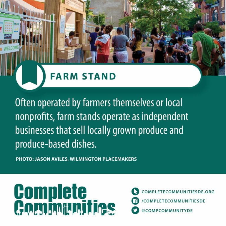
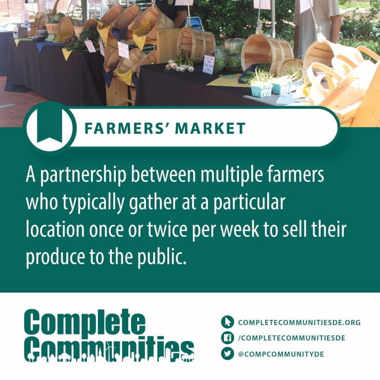
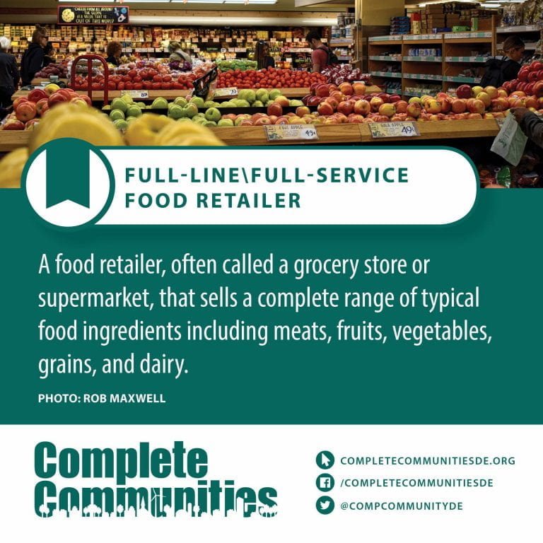
Farmers’ Market – A farmers’ market (or farmers market according to the AP stylebook, also farmer’s market in the Cambridge Dictionary) is a physical retail marketplace intended to sell foods directly by farmers to consumers. Farmers’ markets may be indoors or outdoors and typically consist of booths, tables or stands where farmers sell their produce, live animals and plants, and sometimes prepared foods and beverages. Farmers’ markets exist in many countries worldwide and reflect the local culture and economy. The size of the market may be just a few stalls or it may be as large as several city blocks. Due to their nature, they tend to be less rigidly regulated than retail produce shops.
They are distinguished from public markets, which are generally housed in permanent structures, open year-round, and offer a variety of non-farmer/non-producer vendors, packaged foods and non-food products.
Foreign-born – Foreign-born (also non-native) people are those born outside of their country of residence. Foreign born are often non-citizens, but many are naturalized citizens of the country in which they live, and others are citizens by descent, typically through a parent.
The term foreign born encompasses both immigrants and expatriates but is not synonymous with either. Foreign born may, like immigrants, have committed to living in a country permanently or, like expatriates, live abroad for a significant period with the plan to return to their birth-country eventually.
The status of foreign born — particularly their access to citizenship — differs globally. The large groups of foreign-born guest workers in the Gulf Cooperation Council states, for example, have no right to citizenship no matter the length of their residence. In the United Kingdom, Canada, Australia and the United States, by contrast, foreign born are often citizens or in the process of becoming citizens. Certain countries have intermediary rules: in Germany and Japan it is often difficult but not impossible for the foreign born to become citizens.
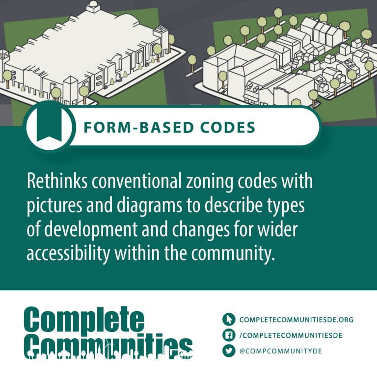
Form based codes – A form-based code is a land development regulation that fosters predictable built results and a high-quality public realm by using physical form (rather than separation of uses) as the organizing principle for the code. A form-based code is a regulation, not a mere guideline, adopted into city, town, or county law. A form-based code offers a powerful alternative to conventional zoning regulation.
G - Terms
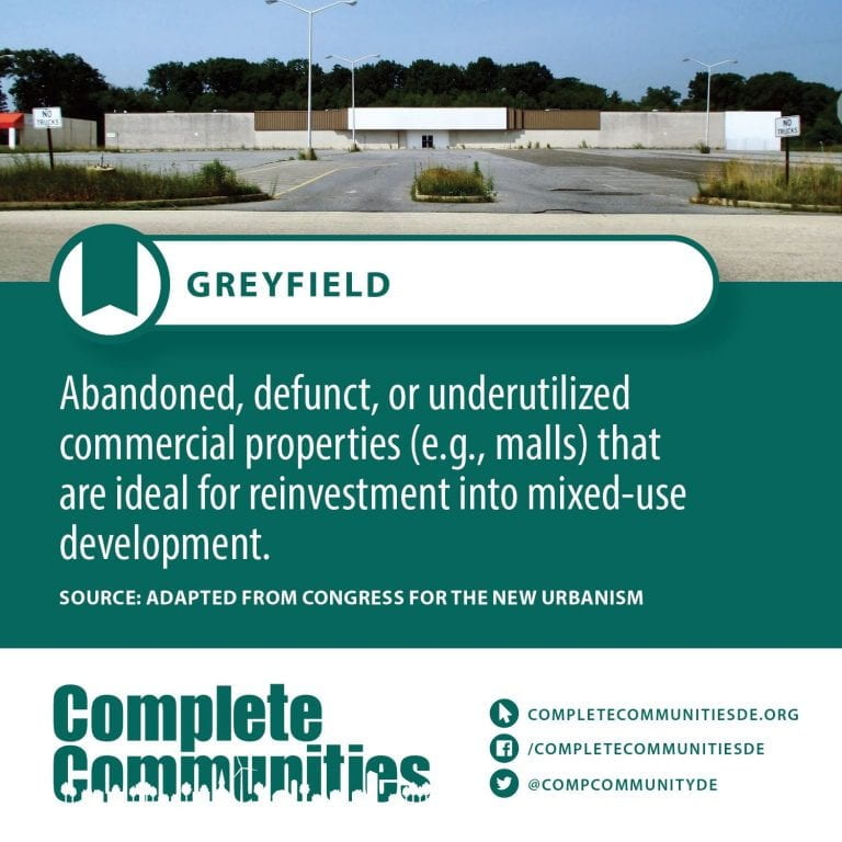
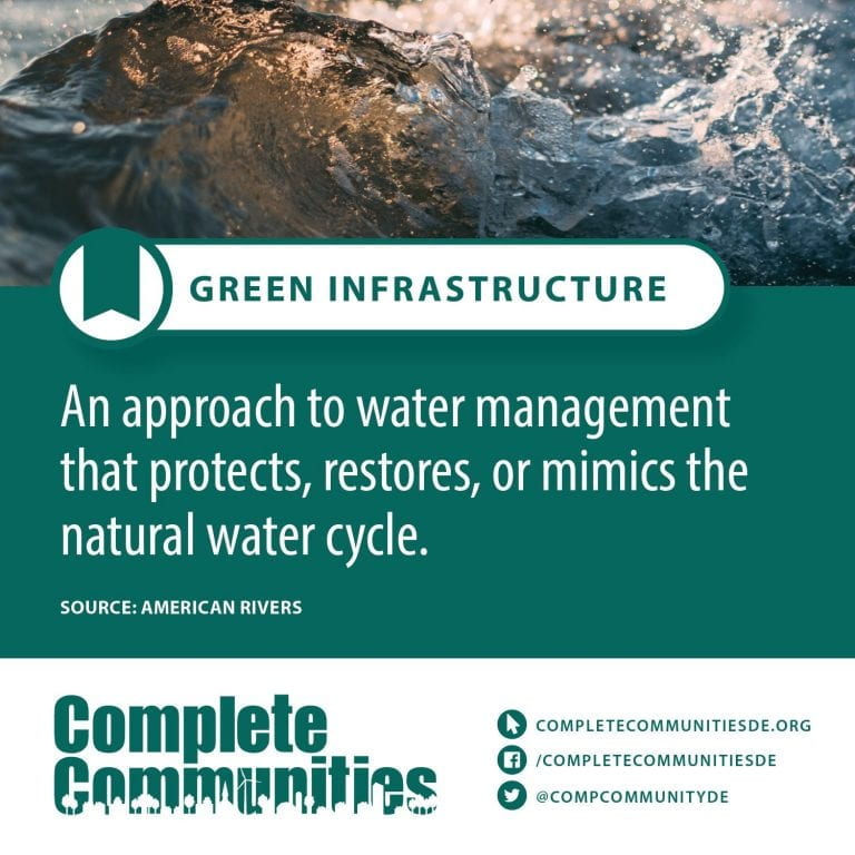
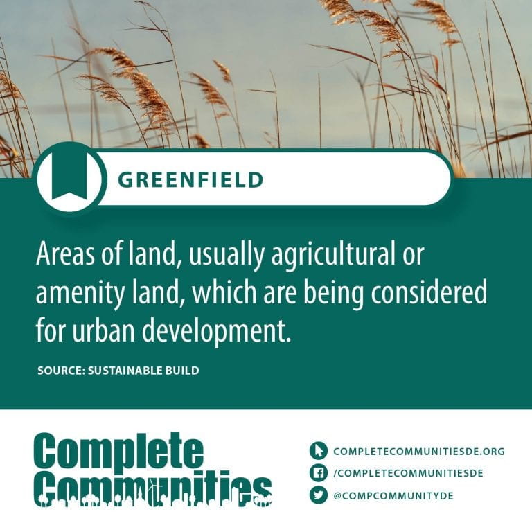
Your content goes here. Edit or remove this text inline or in the module Content settings. You can also style every aspect of this content in the module Design settings and even apply custom CSS to this text in the module Advanced settings.
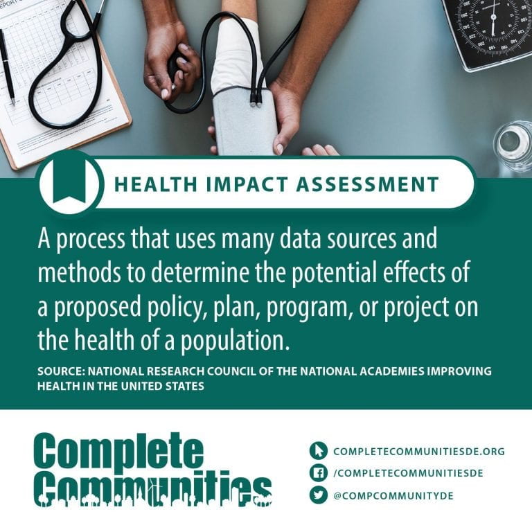
H - Terms
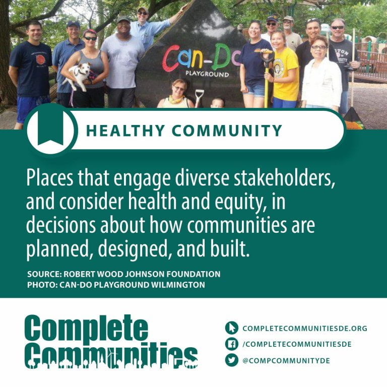
Healthy Community – A healthy community does not exist solely based on the quality of its healthcare system, but rather based on a range of social and economic resources needed for the health and well-being of its residents in all aspects of their lives. For this reason, PHC wants to make sure we focus on the broad determinants of health, as well as, encouraging our partners to do the same. To understand our partnerships and goals is to understand what kind of community we want to create.
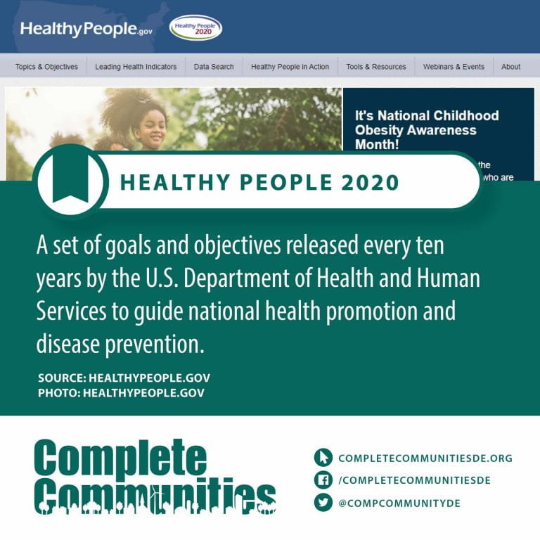
Healthy People 2020 – Healthy People provides science-based, 10-year national objectives for improving the health of all Americans. For 3 decades, Healthy People has established benchmarks and monitored progress over time in order to:
- Encourage collaborations across communities and sectors.
- Empower individuals toward making informed health decisions.
- Measure the impact of prevention activities.
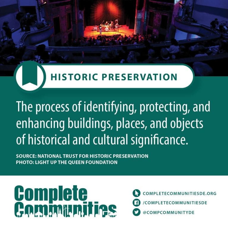
Historic Preservation – Historic preservation (US), heritage preservation or heritage conservation (UK), is an endeavor that seeks to preserve, conserve and protect buildings, objects, landscapes or other artifacts of historical significance. It is a philosophical concept that became popular in the twentieth century, which maintains that cities as products of centuries’ development should be obligated to protect their patrimonial legacy. The term refers specifically to the preservation of the built environment, and not to preservation of, for example, primeval forests or wilderness.
Historical Marker – Plaques and signs placed throughout the state to commemorate and visually educate the public about the people, places, and events that are significant to Delaware’s state, local, and national history.
I - Terms
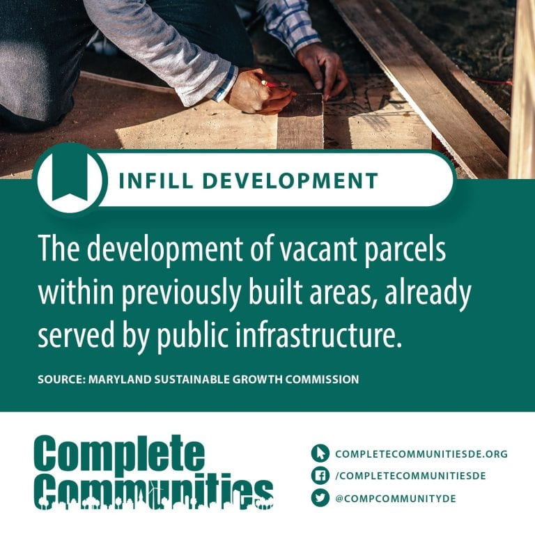
Infill Development – Infill development is the process of developing vacant or under-used parcels within existing urban areas that are already largely developed. Most communities have significant vacant land within city limits, which, for various reasons, has been passed over in the normal course of urbanization.
J - Terms
Your content goes here. Edit or remove this text inline or in the module Content settings. You can also style every aspect of this content in the module Design settings and even apply custom CSS to this text in the module Advanced settings.
K - Terms
Your content goes here. Edit or remove this text inline or in the module Content settings. You can also style every aspect of this content in the module Design settings and even apply custom CSS to this text in the module Advanced settings.
L - Terms
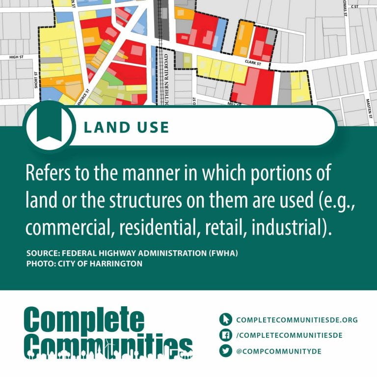
Land Use – Land use involves the management and modification of natural environment or wilderness into built environment such as settlements and semi-natural habitats such as arable fields, pastures, and managed woods. Land use by humans has a long history, first emerging more than 10 thousand years ago. It has been defined as “the purposes and activities through which people interact with land and terrestrial ecosystems” and as “the total of arrangements, activities, and inputs that people undertake in a certain land type.” Land use is one of the most important drivers of global environmental change.
Land Use codes – This code is used to identify the use of a property. Some properties will have multiple uses such as a store (1100) and a single family (0100) on the same property. The code for this type of property would be (1200) mixed use. Another example would be an agricultural property (6000) with a section of land set aside for single-family use. This can be classified as the minority land use (0100) as an alternate LUC.
Lighter, Quicker, and Cheaper (LCQ) – Lighter, Quicker, Cheaper (LQC) is a strategy to build quality public spaces from the bottom-up. LQC projects can include anything from installing planter boxes to implementing temporary street closures for outdoor dining and shopping or beautifying a neighborhood sidewalk. Although the possibilities are endless, these projects have a few attributes in common: they are light, they are quick and they are cheap.
Implementing LQC projects allows cities to experiment and be flexible to adapt to changing needs over time. The interactive nature of LQC projects helps build, or in some cases, rebuild trust among stakeholders and pave the way for “tested” larger-scale capital investments. LQC provides a “low-cost, high-impact incremental framework” to improve access to public space that centers community voice.
Limited English proficiency – Limited English proficiency (LEP) is a term used in the United States that refers to a person who is not fluent in the English language, often because it is not their native language. Both LEP and English-language learner (ELL) are terms used by the Office for Civil Rights, a sub-agency of the U.S. Department of Education.
According to data collected from the U.S. Census Bureau and Census Bureau American Community Survey (ACS) data, LEP individuals accounted for 9% of the U.S. population over the age of five.
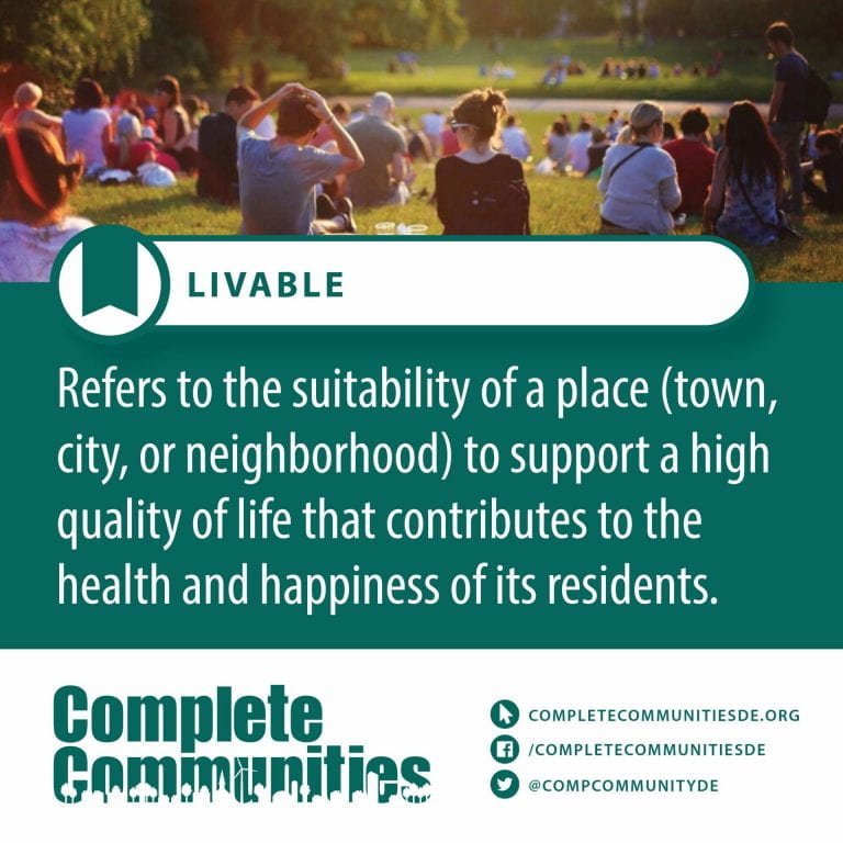
Livable – Suitable for living in, on, or with
Living Lab – A living lab, or living laboratory, is a research concept, which may be defined as a user-centered, iterative, open-innovation ecosystem, often operating in a territorial context (e.g. city, agglomeration, region or campus), integrating concurrent research and innovation processes within a public-private-people partnership.
Low-income – Each of us might have a different idea of what constitutes “low-income.” Where you live matters, too. In San Francisco, for example, a person needs to make $61 per hour to afford a two-bedroom apartment in 2019, according to the National Low-Income Housing Coalition. In North Dakota, that sort of salary could put a family into a large house with a yard.
The federal government has its own definitions of “low income.” The definitions matter, because agencies use them to determine which households qualify for tax breaks and other government benefits.
By government standards, “low-income” earners are men and women whose household income is less than double the Federal Poverty Level (FPL). For a single person household, the 2019 FPL was $12,490 a year. That means that a single person making less than $25,000 a year would be considered low income. For a five-person household, the FPL is $30,170 and the cut-off for low income is $60,340.
There are significant racial disparities within the low income earner population. A study in 2015 revealed that households headed by racial minorities were nearly twice as likely to be low-income or poor as non-minority households. Hispanic and African-American households have median incomes significantly lower than non-Hispanic white and Asian households.
If your household is less than four times the poverty level, you may be eligible for some type of government assistance. Knowing where you stand can reveal which benefits are available and unavailable to you. For example, in some states, a household at 1.5 times the FPL would qualify for reduced-price school lunches, but not SNAP (food stamp) benefits. It’s important to look into your state’s standards for each program.
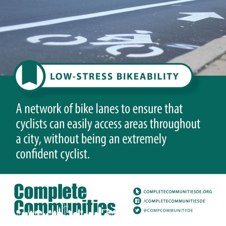
Low-stress Bikeability – Designed to guide local governments in evaluating the extent to which average bicycle riders can easily access low-stress areas, and in developing strategies to leverage state investments to improve local cycling networks and bicycle infrastructure.
M - Terms
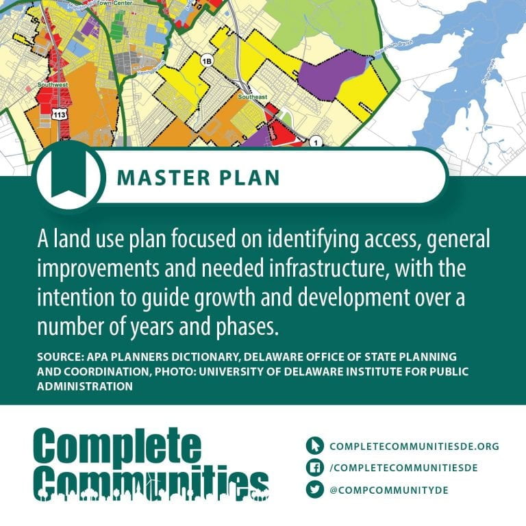
Master planning – Comprehensive planning is an ordered process that determines community goals and aspirations in terms of community development. The end product is called a comprehensive plan, also known as a general plan, or master plan. This resulting document expresses and regulates public policies on transportation, utilities, land use, recreation, and housing. Comprehensive plans typically encompass large geographical areas, a broad range of topics, and cover a long-term time horizon. The term comprehensive plan is most often used by urban planners in the United States.
Each city and county adopts and updates their plan to guide the growth and land development of their community, for both the current period and the long term. This “serious document” is then the foundation for establishing goals, purposes, zoning and activities allowed on each land parcel to provide compatibility and continuity to the entire region as well as each individual neighborhood. It has been one of the most important instruments in city and regional planning since the early twentieth century.
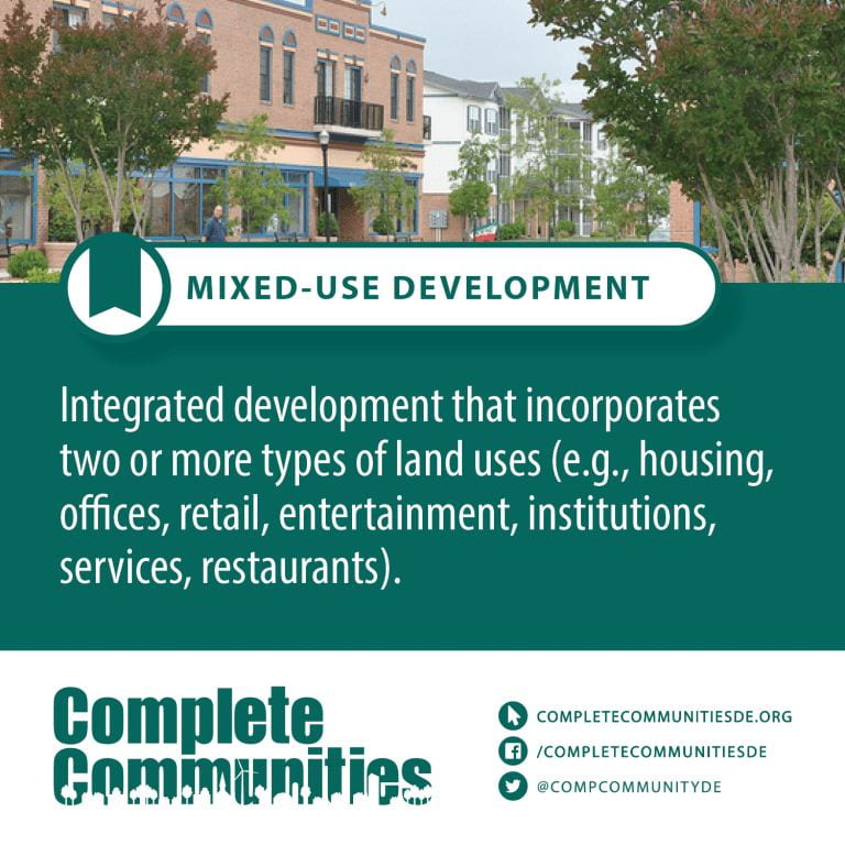
Mixed-use Development – Mixed-use is a kind of urban development, urban design, urban planning and/or a zoning type that blends multiple uses, such as residential, commercial, cultural, institutional, or entertainment, into one space, where those functions are to some degree physically and functionally integrated, and that provides pedestrian connections. Mixed-use development may be applied to a single building, a block or neighborhood, or in zoning policy across an entire city or other administrative unit. These projects may be completed by a private developer, (quasi-) governmental agency, or a combination thereof. A mixed-use development may be a new construction, reuse of an existing building or brownfield site, or a combination.
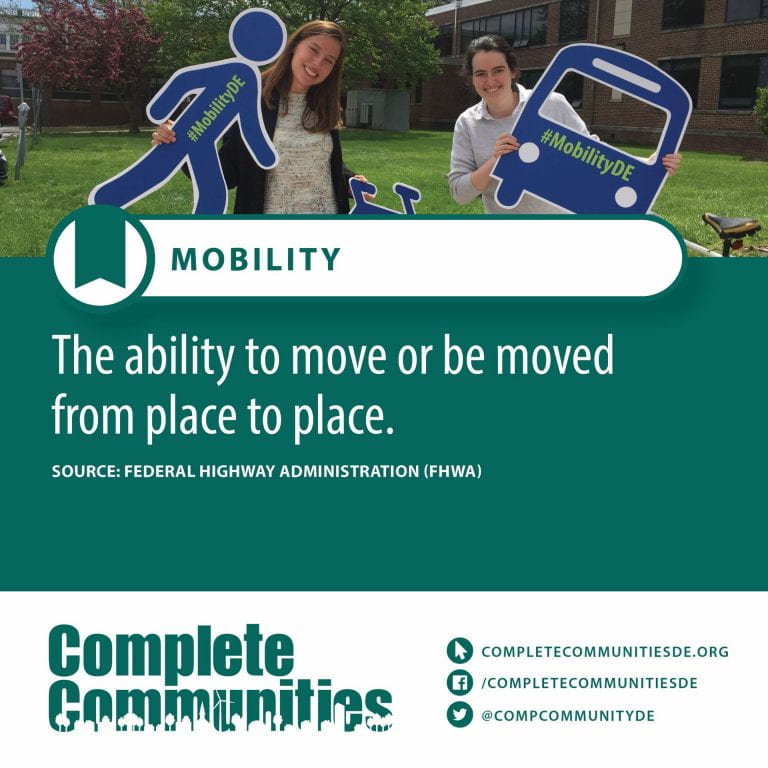
Mobility – The differentiation between the terms accessibility and mobility is useful in the context of policy development. Mobility is defined as the potential for movement and the ability to get from one place to another using one or more modes of transport to meet daily needs. As such, it differs from accessibility, which refers to the ability to access or reach a desired service or activity. To illustrate this, it is possible to have good mobility, but poor accessibility. For example, a community with a good highway network and low levels of congestion, but with relatively few employment, shopping and leisure opportunities, has good mobility but poor accessibility. Nevertheless, policies to increase mobility do generally increase accessibility by making it easier to reach destinations further away.
Mobility focuses on the satisfaction of needs, while transport (including vehicles, infrastructure and traffic rules) is the instrument which is required for the concrete realization of mobility. Consequently, mobility is a direct result of social activities such as living, working, relaxing and production, trade and consumption (for goods). Due to spatial separation of activities, a demand for transport services arises. The type of transport services chosen to meet this need for mobility is the result of a political process.
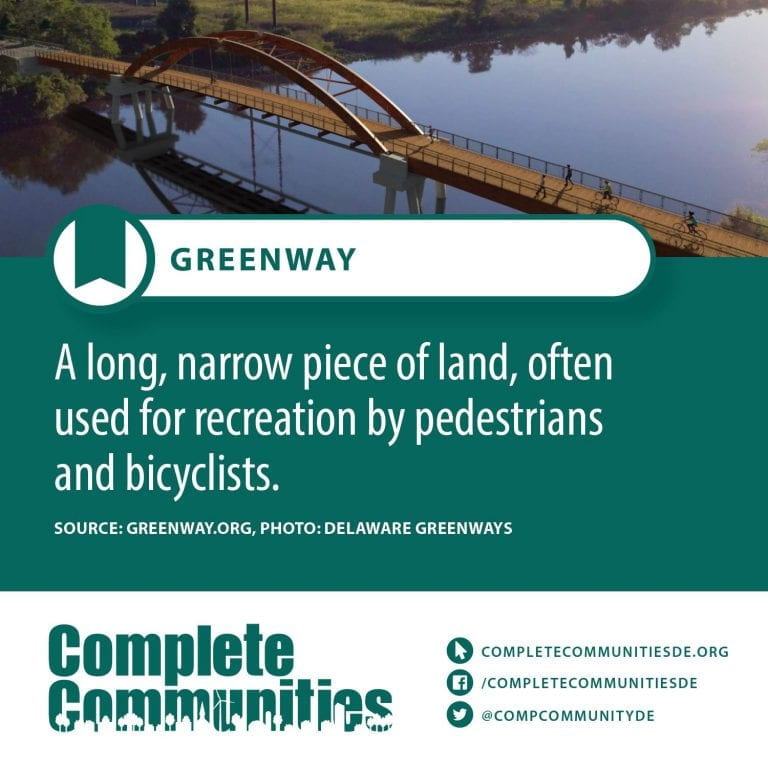
Multi-use Path – Shared use paths are facilities on exclusive right-of-way and with mini-mal cross flow by motor vehicles. Shared use paths are sometimes referred to as trails; however, in many states the term trail means an un-improved recreational facility. Care should be taken in using these terms interchangeably. Where shared use paths are called trails, they should meet all design criteria for shared use paths to be designated as bicycle facilities. Users are non-motorized and may include but are not limited to: bicyclists, in-line skaters, roller skaters, wheelchair users (both non-motorized and motorized) and pedestrians, including walkers, runners, people with baby strollers, people walking dogs, etc. These facilities are most commonly designed for two-way travel, and the guidance herein assumes a two-way facility is planned unless otherwise stated.
Shared use paths can serve a variety of purposes. They can provide users with a shortcut through a residential neighborhood (e.g., a connection between two cul-de-sac streets). Located in a park, they can provide an enjoyable recreational opportunity. Shared use paths can be located along rivers, ocean fronts, canals, abandoned or active railroad and utility rights-of-way, limited access freeways, within college campuses or within and between parks. Shared use paths can also provide bicycle access to areas that are otherwise served only by limited access highways closed to bicycles. Appropriate locations can be identified during the planning process.
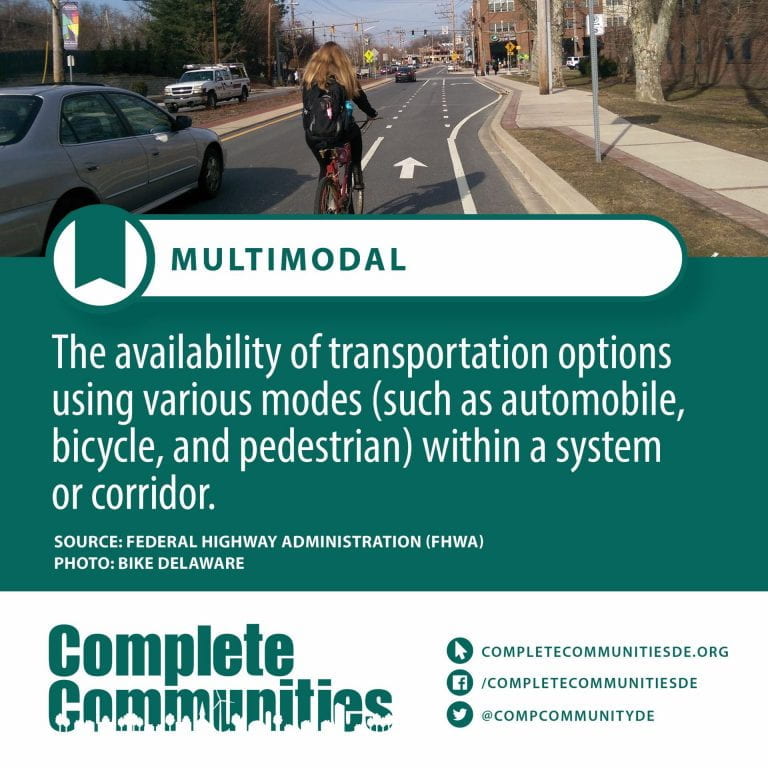
Multimodal – Multimodal transport (also known as combined transport) is the transportation of goods under a single contract, but performed with at least two different modes of transport; the carrier is liable (in a legal sense) for the entire carriage, even though it is performed by several different modes of transport (by rail, sea and road, for example). The carrier does not have to possess all the means of transport, and in practice usually does not; the carriage is often performed by sub-carriers (referred to in legal language as “actual carriers”). The carrier responsible for the entire carriage is referred to as a multimodal transport operator, or MTO.
Article 1.1. of the United Nations Convention on International Multimodal Transport of Goods (Geneva, 24 May 1980) (which will only enter into force 12 months after 30 countries ratify; as of May 2019, only 6 countries have ratified the treaty) defines multimodal transport as follows: “‘International multimodal transport’ means the carriage of goods by at least two different modes of transport on the basis of a multimodal transport contract from a place in one country at which the goods are taken in charge by the multimodal transport operator to a place designated for delivery situated in a different country”.
N - Terms
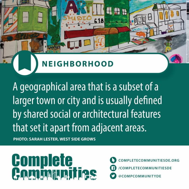
Neighborhood – A neighborhood (British English, Hibernian English, Australian English and Canadian English) or neighborhood (American English; see spelling differences) is a geographically localized community within a larger city, town, suburb or rural area. Neighborhoods are often social communities with considerable face-to-face interaction among members. Researchers have not agreed on an exact definition, but the following may serve as a starting point: “Neighborhood is generally defined spatially as a specific geographic area and functionally as a set of social networks. Neighborhoods, then, are the spatial units in which face-to-face social interactions occur—the personal settings and situations where residents seek to realize common values, socialize youth, and maintain effective social control.”
O - Terms
Older adults – An older person is defined by the United Nations as a person who is over 60 years of age. However, families and communities often use other socio-cultural referents to define age, including family status (grandparents), physical appearance, or age-related health conditions. The psychological and psychosocial toll of traumatic experiences, combined with poor nutrition and exposure to disease, can cause refugees and IDPs to ‘age’ faster than settled populations. As a consequence, many challenges associated with old age will be apparent in refugees and IDPs who are under 60.
The needs and capacities of older persons are often overlooked in an emergency response because humanitarian actors do not register their presence or because of their weak socio-economic position. An emergency response that fully includes older persons must respond to their specific needs, dedicate resources to them,and plan and implement targeted protection initiatives in close consultation with the persons concerned, their communities, and service providers.
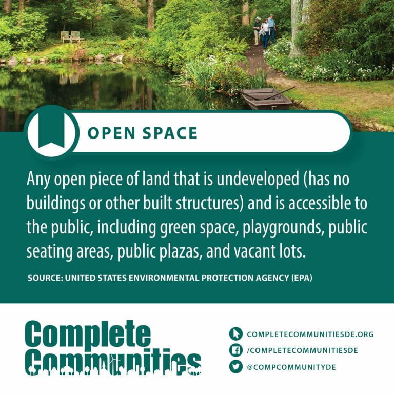
Open space – In land-use planning, urban green space is open-space areas reserved for parks and other “green spaces”, including plant life, water features -also referred to as blue spaces- and other kinds of natural environment. Most urban open spaces are green spaces, but occasionally include other kinds of open areas. The landscape of urban open spaces can range from playing fields to highly maintained environments to relatively natural landscapes.
Generally considered open to the public, urban green spaces are sometimes privately owned, such as higher education campuses, neighborhood/community parks/gardens, and institutional or corporate grounds. Areas outside city boundaries, such as state and national parks as well as open space in the countryside, are not considered urban open space. Streets, piazzas, plazas and urban squares are not always defined as urban open space in land use planning. Urban green spaces have wide reaching positive impacts on the health of individuals and communities near the green space.
Urban greening policies are important for revitalizing communities, reducing financial burdens of healthcare and increasing quality of life. Most policies focus on community benefits, and reducing negative effects of urban development, such as surface runoff and the urban heat island effect. Historically, access to green space has favored wealthier, and more privileged communities, thus recent focus in urban greening has increasingly focused on environmental justice concerns, and community engagement in the greening process. In particular, in cities with economic decline, such as the Rust Belt in the United States, urban greening has broad community revitalization impacts.
Urban areas have greatly expanded and resulted in over half of the world’s population to be located in urban locations. As the population continues to grow, this number is predicted to be at two-thirds of people living in urban areas by 2050.
P - Terms
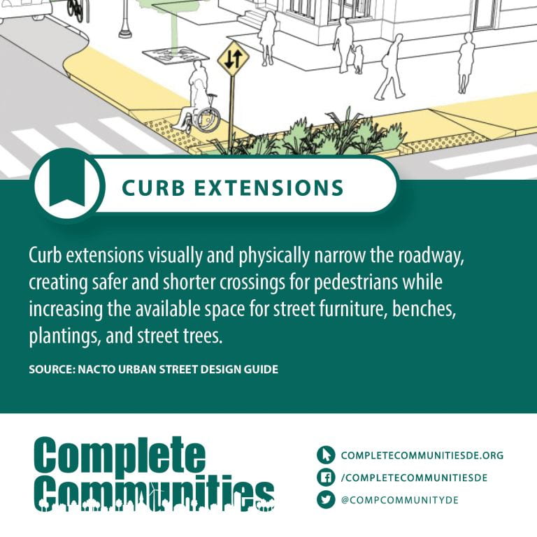
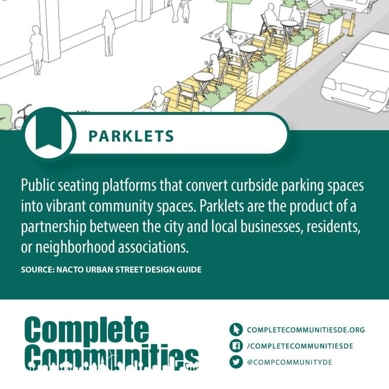
Parklet – A parklet is a sidewalk extension that provides more space and amenities for people using the street. Usually parklets are installed on parking lanes and use several parking spaces. Parklets typically extend out from the sidewalk at the level of the sidewalk to the width of the adjacent parking space.
Parklets are intended for people. Parklets offer a place to stop, to sit, and to rest while taking in the activities of the street. In instances where a parklet is not intended to accommodate people, it may provide greenery, art, or some other visual amenity. A parklet may accommodate bicycle parking within it, or bicycle parking may be associated with it.
A parklet may be thought of as permanent, but must be designed for quick and easy removal for emergencies or other reasons such as snow removal without damage to the curb or street. As initially conceived, a parklet is always open to the public. However, some cities have allowed restaurants to create parklets that are not open to the public such as Long Beach, California, Fargo, North Dakota and Montreal, Quebec.
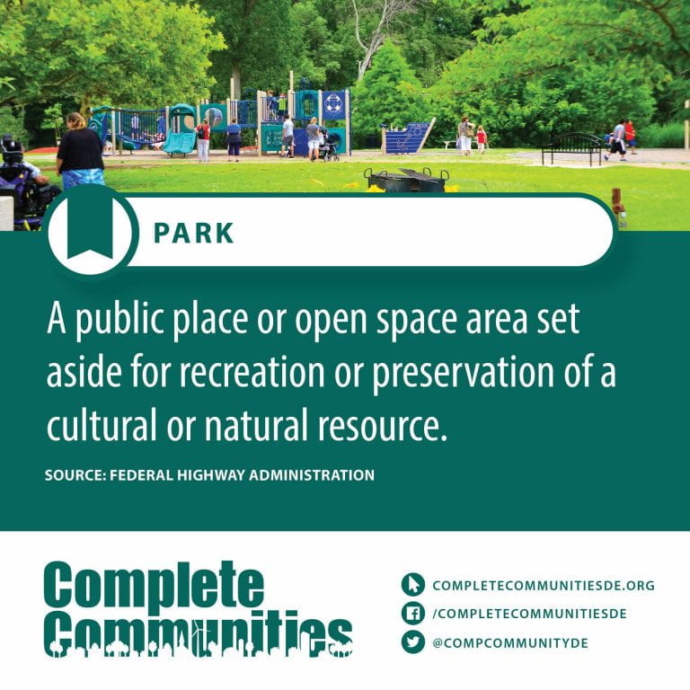
Parks – A park is an area of natural, semi-natural or planted space set aside for human enjoyment and recreation or for the protection of wildlife or natural habitats. Urban parks are green spaces set aside for recreation inside towns and cities. National parks and country parks are green spaces used for recreation in the countryside. State parks and provincial parks are administered by sub-national government states and agencies. Parks may consist of grassy areas, rocks, soil and trees, but may also contain buildings and other artifacts such as monuments, fountains or playground structures. Many parks have fields for playing sports such as baseball and football, and paved areas for games such as basketball. Many parks have trails for walking, biking and other activities. Some parks are built adjacent to bodies of water or watercourses and may comprise a beach or boat dock area. Urban parks often have benches for sitting and may contain picnic tables and barbecue grills.
The largest parks can be vast natural areas of hundreds of thousands of square kilometers (or square miles), with abundant wildlife and natural features such as mountains and rivers. In many large parks, camping in tents is allowed with a permit. Many natural parks are protected by law, and users may have to follow restrictions (e.g. rules against open fires or bringing in glass bottles). Large national and sub-national parks are typically overseen by a park ranger. Large parks may have areas for canoeing and hiking in the warmer months and, in some northern hemisphere countries, cross-country skiing and snowshoeing in colder months. There are also amusement parks that have live shows, fairground rides, refreshments, and games of chance or skill.
Parks and Recreation – Parks and recreation are resources and services provided for the purposes of leisure, entertainment, and recreational pursuits. Resources may be public spaces and facilities like parks, nature preserves, open space areas, greenways, trails, and built structures for sport, recreation, or arts programs. Examples of services include recreation activity programs, athletic leagues, special events, arts programs, and environmental education programs.
The field of parks and recreation also encompasses resources and services offered by sector, though they are only delivered to members or paying visitors. Examples include YMCAs, health and fitness centers, resorts, and guide services.
There are also quasi-public providers like power companies, land trusts, and other authorities that manage resources that may be used for recreation purposes. An example in Connecticut is the MDC reservoir trail.
Paved Trail – A trail is usually a path, track or unpaved lane or road. In the United Kingdom and the Republic of Ireland, path or footpath is the preferred term for a walking trail. The term is also applied in North America to routes along rivers, and sometimes to highways. In the US, the term was historically used for a route into or through wild territory used by emigrants (e.g. the Oregon Trail). In the USA “trace” is a synonym for trail, as in Natchez Trace. Some trails are single use and can be used only for walking, cycling, horse riding, snowshoeing and cross-country skiing; others, as in the case of a bridleway in the UK, are multi-use, and can be used by walkers, cyclists and equestrians. There are also unpaved trails used by dirt bikes and other off-road vehicles, and in some places, like the Alps, trails are used for moving cattle and other livestock.
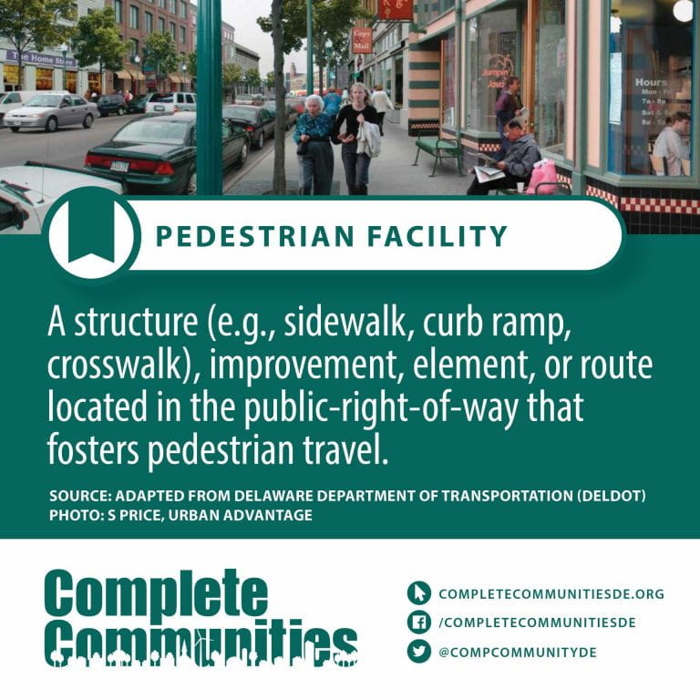
Pedestrian Facilities – Pedestrian facilities include retail shops, museums, mass events (such as festivals or concert halls), hospitals, transport hubs (such as train stations or airports), sports infrastructure (such as stadiums) and religious infrastructures. The transport mode in such infrastructures is mostly walking, with rare exceptions.
Challenges for the management of such facilities include knowing the number of visitors, determining the source of congestion, localizing the different points of interest, the design of the facility and possibly defining timetables in the case of transport hubs.
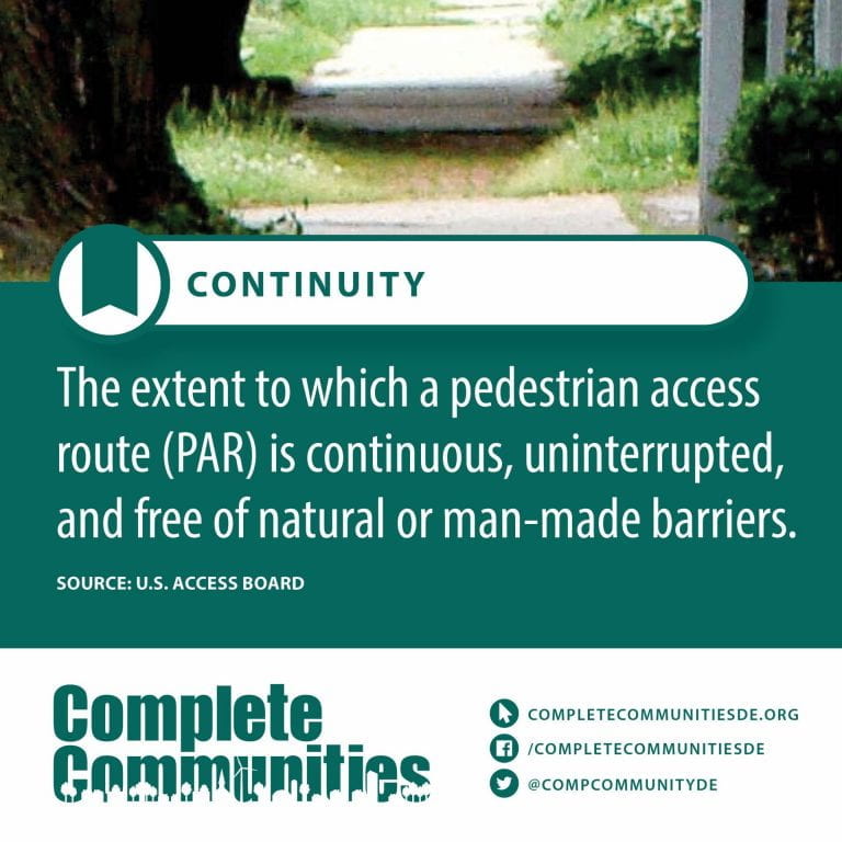
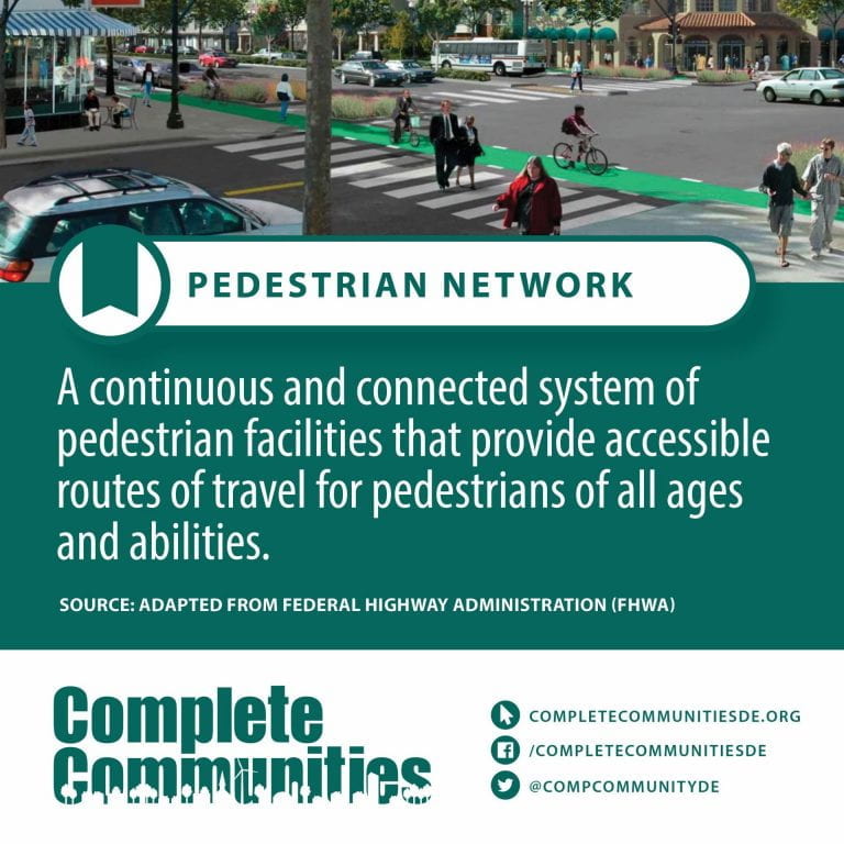
Pedestrian Network – Fine-grain pedestrian networks with a variety of pedestrian-priority spaces support a walkable city. Continuous sidewalks that are free of obstructions, frequent at-grade crossings, and small blocks allow pedestrians to conveniently and safely reach their destinations. Interesting and permeable building edges designed with human scale in mind provide an engaging and enjoyable walking experience.
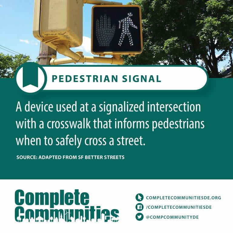
Pedestrian Signals – A pedestrian signal allows a safer way for pedestrians to cross the street at signalized intersections. The pedestrian signal, when activated, provides time for the pedestrian to enter the street on the steady “Walk” and to finish crossing the street on the flashing “Don’t Walk” signal. The pedestrian signal is normally activated by a pedestrian detector push-button, that causes the controller to operate a pre-programmed timed sequence of steady “Walk” and flashing “Don’t Walk” signals.
Pedestrian signal indications consist of “Walk” and “Don’t Walk” signals or international symbols displaying a person walking for “Walk” and a hand for “Don’t Walk”. The “Walk” or person walking symbol is displayed in white and the “Don’t Walk” or hand symbol is displayed in Portland orange.
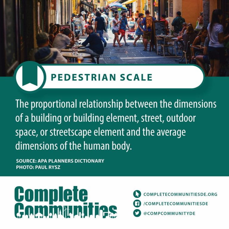
Pedestrian-Scale Design – Pedestrian scale means site and building design elements that are dimensionally less than those intended to accommodate automobile traffic, flow and buffering.
Pilot Projects – A pilot study, pilot project, pilot test, or pilot experiment is a small-scale preliminary study conducted to evaluate feasibility, duration, cost, adverse events, and improve upon the study design prior to performance of a full-scale research project.
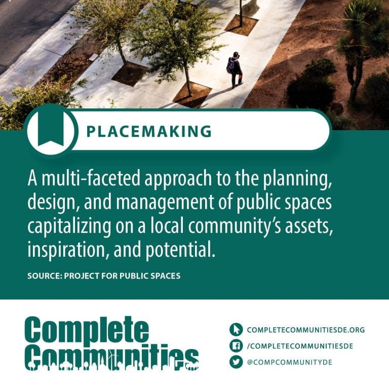
Placemaking – Placemaking is a multi-faceted approach to the planning, design and management of public spaces. Placemaking capitalizes on a local community’s assets, inspiration, and potential, with the intention of creating public spaces that promote people’s health, happiness, and well-being. It is political due to the nature of place identity. Placemaking is both a process and a philosophy that makes use of urban design principles. It can be either official and government led, or community driven grass roots tactical urbanism, such as extending sidewalks with chalk, paint, and planters, or open streets events such as Bogotá, Colombia’s Ciclovía. Good placemaking makes use of underutilized space to enhance the urban experience at the pedestrian scale to build habits of locals.
Pocket parks – A pocket park (also known as a parkette, mini-park, vest-pocket park or vesty park) is a small park accessible to the general public. While the locations, elements, and uses of pocket parks vary considerably, the common defining characteristic of a pocket park is its small size. Typically, a pocket park occupies one to three municipal lots and is smaller than one acre in size.
Pocket parks can be urban, suburban or rural, but they customarily appear in densely developed urban areas, where land is very expensive and space for the development of larger urban parks is limited. They are frequently created on small, irregular pieces of public or private land, such as in vacant building lots, in brownfields, beside railways, beneath utility lines, or in parking spots.
Pocket parks can create new public spaces without the need for large-scale redevelopment. In inner-city areas, pocket parks are often part of urban regeneration efforts by transforming underutilized or blighted spaces into vibrant community assets. They may also be created as a component of the public space requirement of large building projects.
Pocket parks can serve as focal points of activity and interest in urban areas. Common elements of pocket parks include benches, tables, fountains, playgrounds, monuments, historic markers, art installations, barbecue pits, flower beds, community gardens, or basketball courts. Although they are often too small for many space-intensive physical activities, pocket parks provide communities with greenery, a place to sit and rest, and an ecological foothold for urban wildlife.
Pop-up Demonstrations – Pop-up demonstration projects — also known as “tactical urbanism,” “do-it-yourself urbanism” or “better blocks” — typically involve community members working together to bring attention to overlooked spaces, address neighborhood issues, or demonstrate desired improvements within a public or sometimes private space such as a vacant building or underused lot.
This can be done through a rapid prototyping process — a “pop-up demonstration” — that uses lighter, cheaper, easily available materials to build interventions that temporarily improve a space.
After all, when it’s possible to illustrate a new idea through a temporary installation or demonstration, a proposed enhancement is better understood, supported and achieved.
Pop-up demonstration projects, which can be organized and implemented quickly or over time, help residents to propel positive community change.
A pop-up demonstration can take many forms (see below), and there are many ways a pop-up project can help solve common problems, such as stagnant economic activity, dangerously designed streets or a lack of community involvement.
Property Zoning – Zoning refers to municipal or local laws or regulations that govern how real property can and cannot be used in certain geographic areas. For example, zoning laws can limit commercial or industrial use of land to prevent oil, manufacturing, or other types of businesses from building in residential neighborhoods.
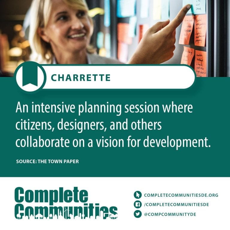
Public Engagement – Public engagement or public participation is a term that has recently been used to describe “the practice of involving members of the public in the agenda-setting, decision-making, and policy-forming activities of organizations/institutions responsible for policy development.” It is focused on the participatory actions of the public to aid in policy making based on their values.
Public Hearing – A public hearing may be a formal meeting for receiving testimony from the public at large on a local issue, or proposed government action. Testimony from both sides of an issue is usually recorded for public record, and a report summarizing the key points is generated. All levels of government hold public hearings – from city on up to the national level. Sometimes, formal public hearings are mandated by law (on the environmental impact of a proposed highway project, for example). In other cases, government officials use them to gather information that will help them in making decisions or drafting legislation.
Public Participation – Public participation, also known as citizen participation or patient and public involvement, is the inclusion of the public in the activities of any organization or project. Public participation is similar to but more inclusive than stakeholder engagement.
Generally public participation seeks and facilitates the involvement of those potentially affected by or interested in a decision. This can be in relation to individuals, governments, institutions, companies or any other entities that affect public interests. The principle of public participation holds that those who are affected by a decision have a right to be involved in the decision-making process. Public participation implies that the public’s contribution will influence the decision. Public participation may be regarded as a form of empowerment and as a vital part of democratic governance. In the context of knowledge management the establishment of ongoing participatory processes is seen by some in the facilitator of collective intelligence and inclusiveness, shaped by the desire for the participation of the whole community or society.
Public participation is part of “people centered” or “human centric” principles, which have emerged in Western culture over the last thirty years, and has had some bearings of education, business, public policy and international relief and development programs. Public participation is advanced by the humanist movements. Public participation may be advanced as part of a “people first” paradigm shift. In this respect public participation may challenge the concept that “big is better” and the logic of centralized hierarchies, advancing alternative concepts of “more heads are better than one” and arguing that public participation can sustain productive and durable change.
Some legal and other frameworks have developed a human rights approach to public participation. For example, the right to public participation in economic and human development was enshrined in the 1990 African Charter for Popular Participation in Development and Transformation. Similarly major environmental and sustainability mechanisms have enshrined a right to public participation, such as the Rio Declaration.
Q - Terms
Your content goes here. Edit or remove this text inline or in the module Content settings. You can also style every aspect of this content in the module Design settings and even apply custom CSS to this text in the module Advanced settings.
R - Terms
Racial minority and ethnic minority – A group of a certain race that are in the minority compared to a larger group, the rest of the population, etc
Recover Delaware – Through Recover Delaware, IPA and its partners will chart a competitive, equitable, and inclusive path forward for Delaware by providing state and local governments, school districts, businesses, and community groups with policy formulation and analysis, strategic planning, and implementation support.
“We started Recover Delaware to motivate ourselves and our public and private partners to tackle the sizable challenges of recovery head on, while also providing one clear entry point for those seeking support,” said IPA Director Jerome Lewis.
IPA Associate Director Troy Mix will lead Recover Delaware with three focus areas for Delaware’s recovery:
Convening public and private sector stakeholders to identify adaptation needs, develop public policies, and pilot and implement programs to advance economic, public health, and social recovery;
Developing recovery strategies for communities and organizations to plan short- and long-term futures and secure resources to implement prioritized initiatives; and
Establishing Delaware as the premier location for remote learning, work, and commerce by advancing programs that provide Delawareans with equitable access to the digital infrastructure, services, and skills they need to learn, work, and access community services remotely.
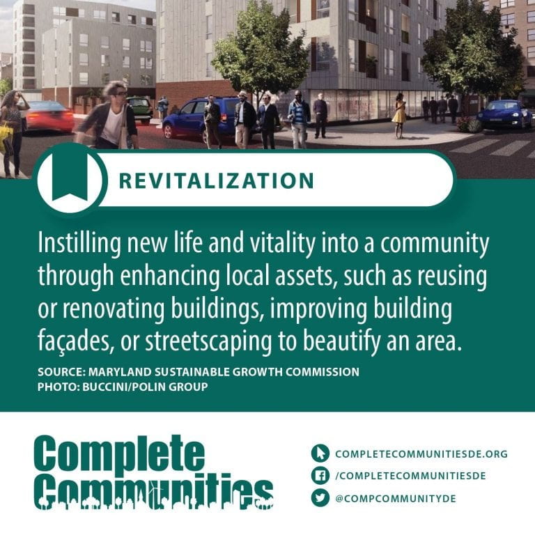
Revitalization – The act or process of giving new life or fresh vitality or energy to someone or something
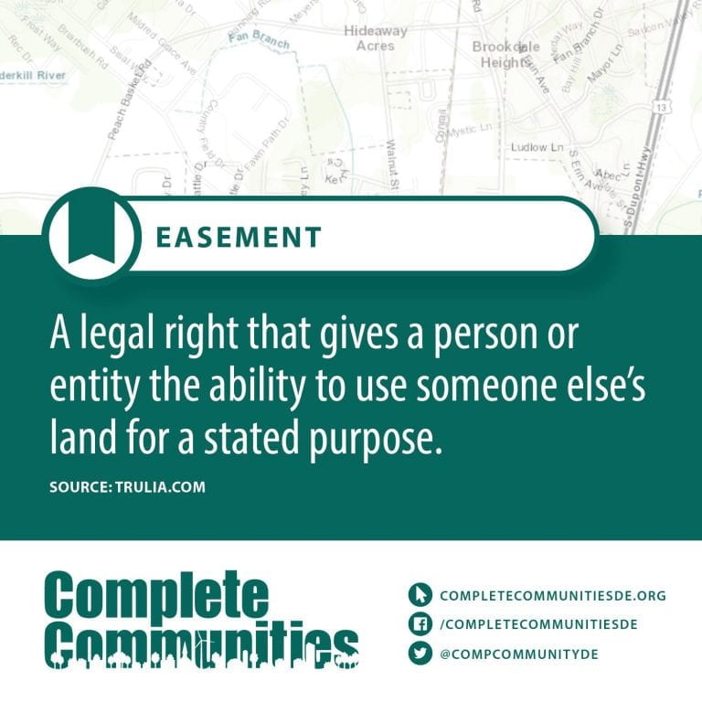
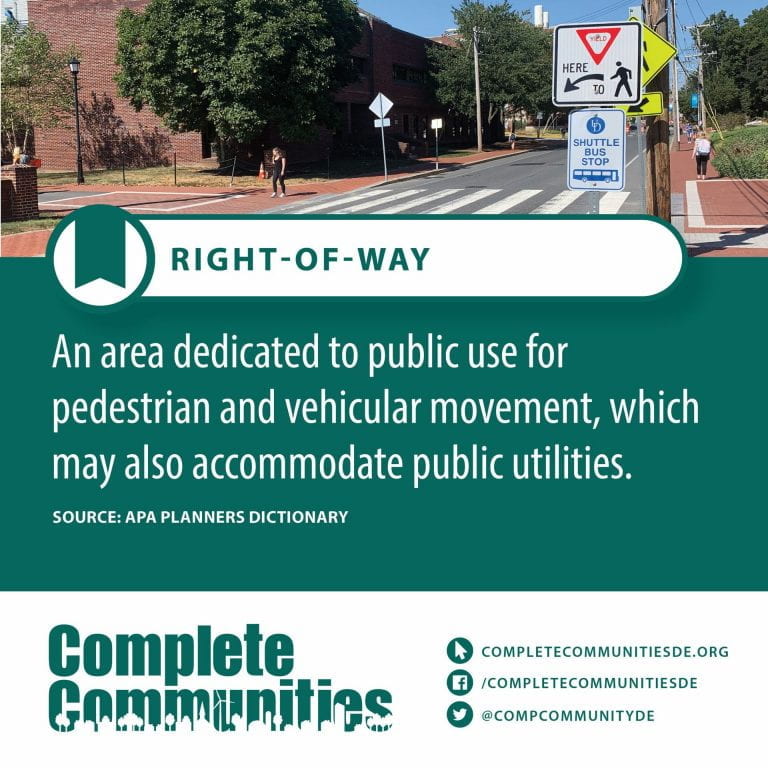
Right of Way – Right of way is the legal right, established by grant from a landowner or long usage (i.e. by prescription), to pass along a specific route through property belonging to another. A similar right of access also exists on land held by a government, lands that are typically called public land, state land, or Crown land. When one person owns a piece of land that is bordered on all sides by lands owned by others, an easement may exist or might be created so as to initiate a right of way through the bordering land.
This article focuses on access by foot, by bicycle, horseback, or along a waterway, while Right-of-way (transportation) focuses on land usage rights for highways, railways, and pipelines.
A footpath is a right of way that legally may only be used by pedestrians. A bridleway is a right of way that legally may be used only by pedestrians, cyclists and equestrians, but not by motorized vehicles. In some countries, especially in Northern Europe, where the freedom to roam has historically taken the form of general public rights, a right of way may not be restricted to specific paths or trails.
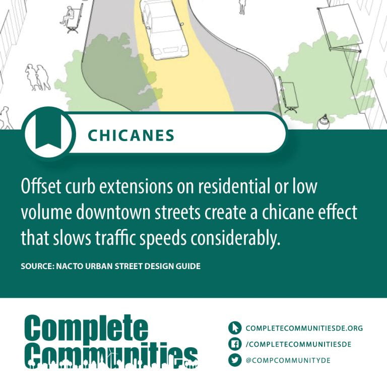
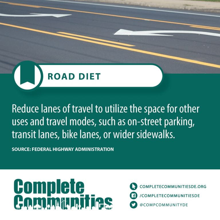
Road Diets – A road diet, also called a lane reduction, road rechannelization, or road conversion is a technique in transportation planning whereby the number of travel lanes and/or effective width of the road is reduced in order to achieve systemic improvements.
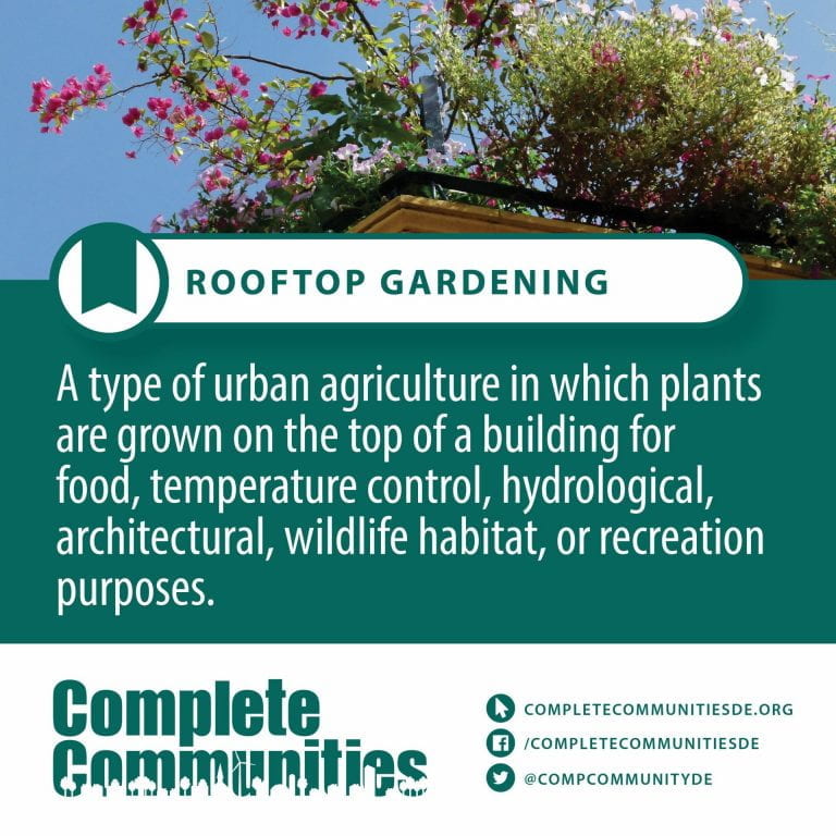
Rooftop Gardening – A roof garden is a garden on the roof of a building. Besides the decorative benefit, roof plantings may provide food, temperature control, hydrological benefits, architectural enhancement, habitats or corridors for wildlife, recreational opportunities, and in large scale it may even have ecological benefits. The practice of cultivating food on the rooftop of buildings is sometimes referred to as rooftop farming. Rooftop farming is usually done using green roof, hydroponics, aeroponics or air-dynaponics systems or container gardens.
S - Terms
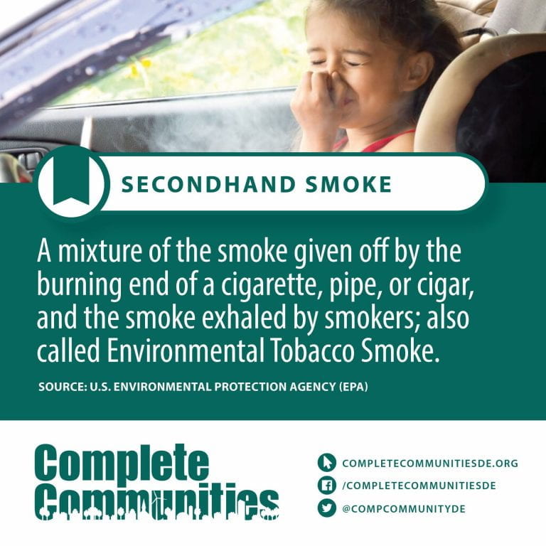
Secondhand Smoke – Passive smoking is the inhalation of tobacco smoke, called secondhand smoke (SHS), or environmental tobacco smoke (ETS), by persons other than the intended “active” smoker. It occurs when tobacco smoke enters an environment, causing its inhalation by people within that environment. Exposure to secondhand tobacco smoke causes disease, disability, and death. The health risks of secondhand smoke are a matter of scientific consensus. These risks have been a major motivation for smoke-free laws in workplaces and indoor public places, including restaurants, bars and nightclubs, as well as some open public spaces.
Concerns around secondhand smoke have played a central role in the debate over the harms and regulation of tobacco products. Since the early 1970s, the tobacco industry has viewed public concern over secondhand smoke as a serious threat to its business interests. Harm to bystanders was perceived as a motivator for stricter regulation of tobacco products. Despite the industry’s awareness of the harms of secondhand smoke as early as the 1980s, the tobacco industry coordinated a scientific controversy with the purpose of stopping regulation of their products.
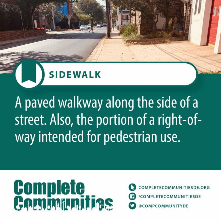
Sidewalk – A sidewalk (North American English), pavement (British English), footpath (Oceanian English), or footway, is a path along the side of a road. Usually constructed of concrete or asphalt, it is designed for pedestrians. A sidewalk may accommodate moderate changes in grade (height) and is normally separated from the vehicular section by a curb (spelled “kerb” outside North America). There may also be a median strip or road verge (a strip of vegetation, grass or bushes or trees or a combination of these) either between the sidewalk and the roadway or between the sidewalk and the boundary.
In some places, the same term may also be used for a paved path, trail or footpath that is not next to a road, for example, a path through a park.
Smokeless Tobacco Products – A type of tobacco that is not smoked or burned. It may be used as chewing tobacco or moist snuff, or inhaled through the nose as dry snuff. Smokeless tobacco contains nicotine and many harmful, cancer-causing chemicals. Using it can lead to nicotine addiction and can cause cancers of the mouth, esophagus, and pancreas. It may also cause heart disease, gum disease, and other health problems.
Social equity – Social equity is concerned with justice and fairness of social policy. Since the 1960s, the concept of social equity has been used in a variety of institutional contexts, including education and public administration.
Streetscaping – Streetscape refers to urban roadway design and conditions as they impact street users and nearby residents. Streetscaping recognizes that streets are places where people engage in various activities, including but not limited to motor vehicle travel. Streetscapes are an important component of the public realm (public spaces where people interact), which help define a community’s aesthetic quality, identity, economic activity, health, social cohesion and opportunity, not just its mobility.
T - Terms
Transportation – Means of conveyance or travel from one place to another
Transit-oriented Development – In urban planning, transit-oriented development (TOD) is a type of urban development that maximizes the amount of residential, business and leisure space within walking distance of public transport. It promotes a symbiotic relationship between dense, compact urban form and public transport use. In doing so, TOD aims to increase public transport ridership by reducing the use of private cars and by promoting sustainable urban growth.
TOD typically includes a central transit stop (such as a train station, or light rail or bus stop) surrounded by a high-density mixed-use area, with lower-density areas spreading out from this center. TOD is also typically designed to be more walkable than other built-up areas, by using smaller block sizes and reducing the land area dedicated to automobiles.
The densest areas of TOD are normally located within a radius of ¼ to ½ mile (400 to 800 m) around the central transit stop, as this is considered to be an appropriate scale for pedestrians, thus solving the last mile problem.
Transportation Improvement District – A geographic area defined for the purpose of securing required improvements to transportation facilities in the area,” as described in the Delaware Department of Transportation’s Development Coordination Manual. A place where land use and transportation is planned in detail in advance, such that development consistent with that planning can pay a readily determined fee and forgo the Traffic Impact Study process.
Threshold Analysis – FDA defines threshold analyses, which “generally are utilized in comparing two drug products,” as: “Conducted to identify differences (if any) that may exist between the proposed combination product’s user interface and the product it references. Consist of labeling comparison, comparative task analysis, and physical comparison of the device constituent part(s).”
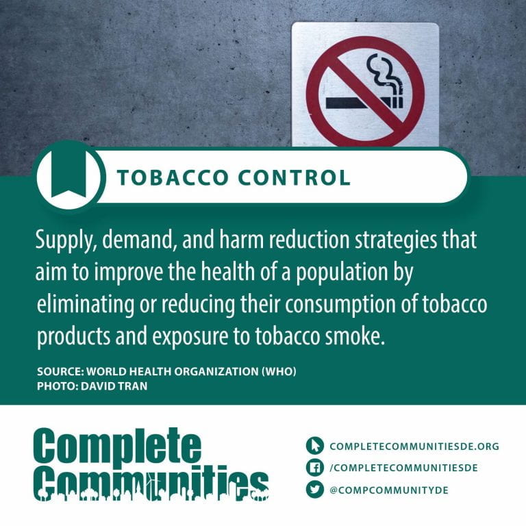
Tobacco Control – Tobacco control, also called anti-smoking, is a field of international public health science, policy and practice dedicated to addressing tobacco use and thereby reducing the morbidity and mortality it causes. Since most cigarettes and cigars and hookahs contain/use tobacco, tobacco control also impacts these. E-cigarettes do not contain tobacco itself, but (often) do contain nicotine. Tobacco control is a priority area for the World Health Organization (WHO), through the Framework Convention on Tobacco Control. References to a tobacco control movement may have either positive or negative connotations.
Tobacco control aims to reduce the prevalence of tobacco use and this is measured with the “age-standardized prevalence of current tobacco use among persons aged 15 years and older”.
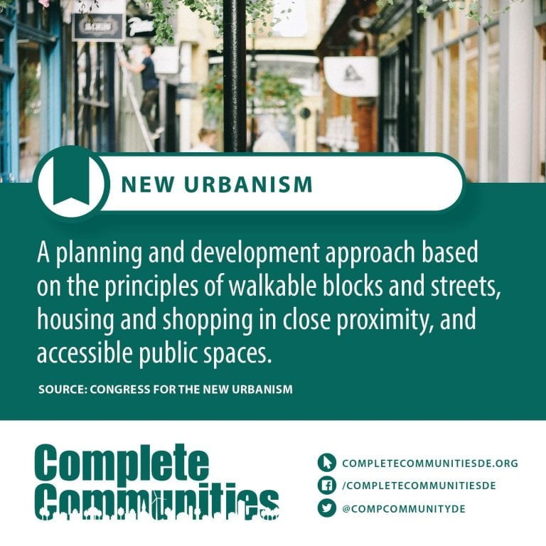
Traditional Neighborhood Development (TND) – Traditional Neighborhood Development (TND) refers to the development of a complete neighborhood or town using traditional town planning principles. TND may occur in infill settings and involve adaptive reuse of existing buildings, but often involves all-new construction on previously undeveloped land. To qualify as a TND, a project should include a range of housing types, a network of well-connected streets and blocks, humane public spaces, and amenities such as stores, schools, and places of worship within walking distance of residences. TND is limited to the scale of neighborhood or town, and should not be confused with New Urbanism, which encompasses all scales of planning and development, from building to region. TND projects incorporate many different architectural styles and are not exclusively traditional in aesthetic. An example of a TND known for modern style as opposed to neotraditional style is Prospect New Town. An example of neotraditional style is Baxter Village near Fort Mill, South Carolina.
Traffic Signals – Traffic lights, traffic signals or stop lights – also known as robots in South Africa – are signaling devices positioned at road intersections, pedestrian crossings, and other locations to control flows of traffic.
Traffic lights normally consist of three signals, transmitting meaning to drivers and riders through colors and symbols including arrows and bicycles. The regular traffic light colors are red, yellow and green, arranged vertically or horizontally in that order. Although this is internationally standardized, variations exist on national and local scales as to traffic light sequences and laws.
Traffic lights were first introduced in December 1868 on Parliament Square in London to reduce the need for police officers to control traffic. Since then, electricity and computerized control has advanced traffic light technology and increased intersection capacity.
Traffic lights are also used for other purposes, such as to control pedestrian movements, variable lane control (such as tidal flow systems or smart motorways) and railway level crossings.
U - Terms
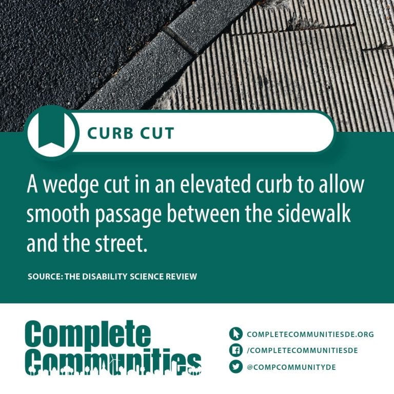
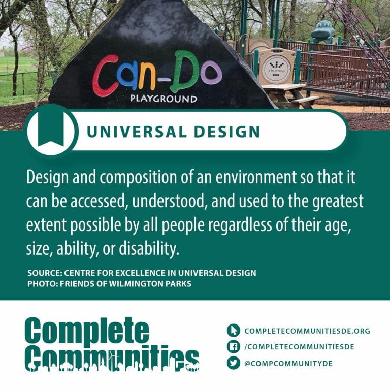
Universal Design – Universal design is the design of buildings, products or environments to make them accessible to all people, regardless of age, disability or other factors
The term “universal design” was coined by the architect Ronald Mace to describe the concept of designing all products and the built environment to be aesthetic and usable to the greatest extent possible by everyone, regardless of their age, ability, or status in life. However, it was the work of Selwyn Goldsmith, author of Designing for the Disabled (1963), who really pioneered the concept of free access for people with disabilities. His most significant achievement was the creation of the dropped curb – now a standard feature of the built environment.
Universal design emerged from slightly earlier barrier-free concepts, the broader accessibility movement, and adaptive and assistive technology and also seeks to blend aesthetics into these core considerations. As life expectancy rises and modern medicine increases the survival rate of those with significant injuries, illnesses, and birth defects, there is a growing interest in universal design. There are many industries in which universal design is having strong market penetration but there are many others in which it has not yet been adopted to any great extent. Universal design is also being applied to the design of technology, instruction, services, and other products and environments.
Curb cuts or sidewalk ramps, essential for people in wheelchairs but also used by all, are a common example. Color-contrast dishware with steep sides that assists those with visual or dexterity problems are another. There are also cabinets with pull-out shelves, kitchen counters at several heights to accommodate different tasks and postures, and, amidst many of the world’s public transit systems, low-floor buses that “kneel” (bring their front end to ground level to eliminate gap) and/or are equipped with ramps rather than on-board lifts.
W - Terms
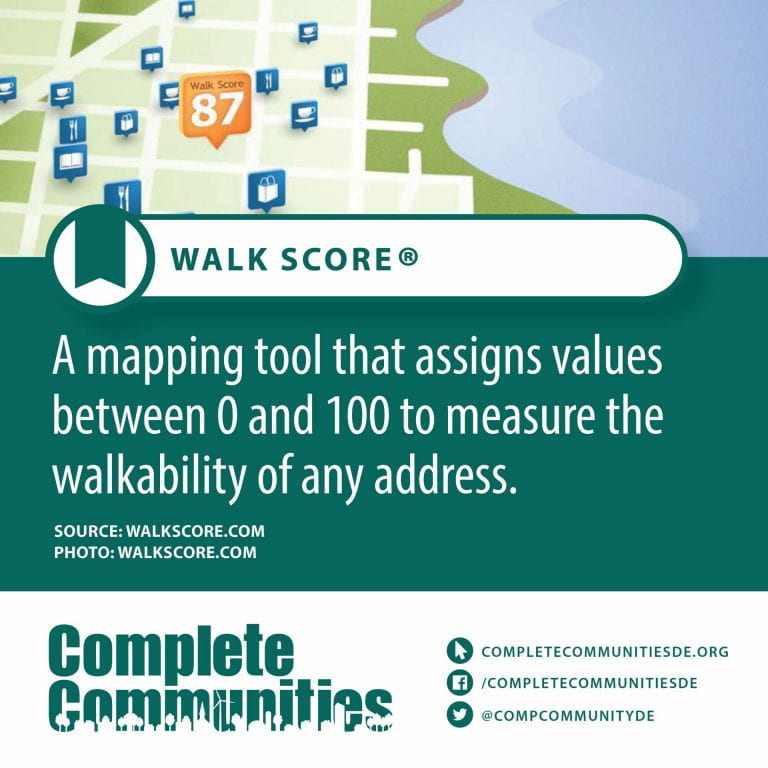
Walk Score – Walk Score measures the walkability of any address using a patented system. For each address, Walk Score analyzes hundreds of walking routes to nearby amenities. Points are awarded based on the distance to amenities in each category. Amenities within a 5 minute walk (.25 miles) are given maximum points. A decay function is used to give points to more distant amenities, with no points given after a 30 minute walk.
Walk Score also measures pedestrian friendliness by analyzing population density and road metrics such as block length and intersection density. Data sources include Google, Factual, Great Schools, Open Street Map, the U.S. Census, Localeze, and places added by the Walk Score user community.
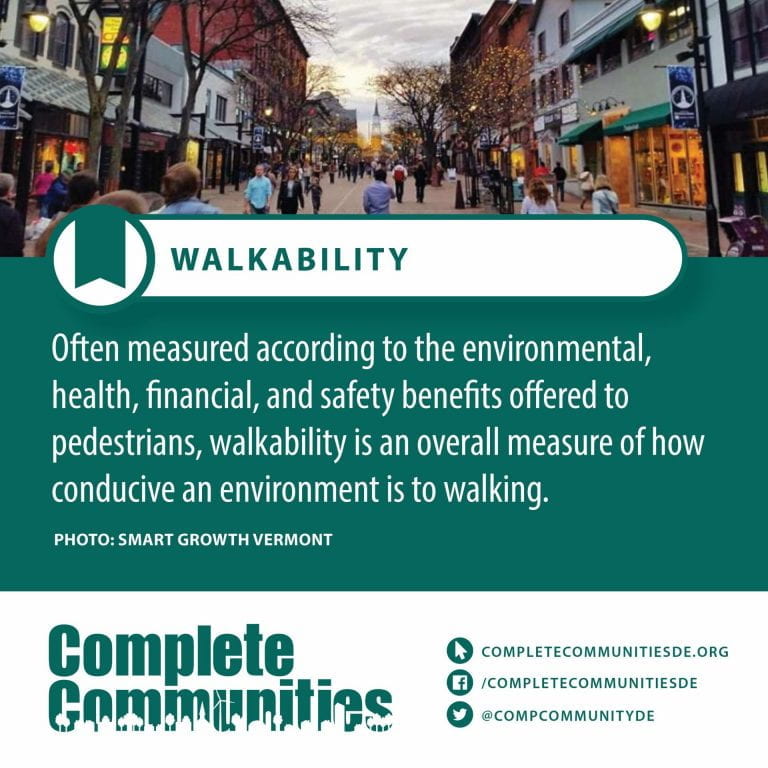
Walkability – Walkability is a nebulous term for planning concepts best understood by the mixed-use of amenities in high-density neighborhoods where people can access said amenities by foot. It is based on the idea that urban spaces should be more than just transport corridors designed for maximum vehicle throughput. Instead, it should be relatively complete livable spaces that serve a variety of uses, users, and transportation modes and reduce the need for cars for travel.
The term ‘walkability’ was primarily invented in the 1960s due to Jane Jacobs’ revolution in urban studies. In recent years, walkability has become popular because of its health, economic, and environmental benefits. It is an essential concept of sustainable urban design. Factors influencing walkability include the presence or absence and quality of footpaths, sidewalks or other pedestrian rights-of-way, traffic and road conditions, land use patterns, building accessibility, and safety, among others
X - Terms
Your content goes here. Edit or remove this text inline or in the module Content settings. You can also style every aspect of this content in the module Design settings and even apply custom CSS to this text in the module Advanced settings.
Y - Terms
Youth – Youth is the time of life when one is young, and often means the time between childhood and adulthood (maturity). It is also defined as “the appearance, freshness, vigor, spirit, etc., characteristic of one who is young”. Its definitions of a specific age range varies, as youth is not defined chronologically as a stage that can be tied to specific age ranges; nor can its end point be linked to specific activities, such as taking unpaid work or having sexual relations.
Youth is an experience that may shape an individual’s level of dependency, which can be marked in various ways according to different cultural perspectives. Personal experience is marked by an individual’s cultural norms or traditions, while a youth’s level of dependency means the extent to which they still rely on their family emotionally and economically.
Z - Terms
Zoning – Zoning is a method of urban planning in which a municipality or other tier of government divides land into areas called zones, each of which has a set of regulations for new development that differs from other zones. Zones may be defined for a single use (e.g. residential, industrial), they may combine several compatible activities by use, or in the case of form-based zoning, the differing regulations may govern the density, size and shape of allowed buildings whatever their use. The planning rules for each zone determine whether planning permission for a given development may be granted. Zoning may specify a variety of outright and conditional uses of land. It may indicate the size and dimensions of lots that land may be subdivided into, or the form and scale of buildings. These guidelines are set in order to guide urban growth and development.
Zoning is the most common regulatory urban planning method used by local governments in developed countries. Exceptions include the United Kingdom and the City of Houston, Texas.
Zoning laws that limit the construction of new housing are associated with reduced affordability and are a major factor in residential segregation in the United States by income and race.
Trading Cards
Curious about a specific Complete Communities topic? Use the buttons below to download printable PDFs of our themed sets of terms-to-know trading cards!
Terms to Know Trading Cards

![]()
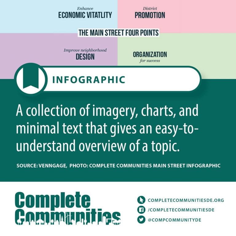
Visual Glossary
Explore our glossary for definitions of key policy and planning terms for building a complete community. These illustrated explanations will help you picture the path to a complete community in your town!
A Terms
![]()
B Terms
C Terms
D Terms

E Terms
![]()
F Terms

G Terms
H Terms
I Terms
L Terms
M Terms

N Terms
O Terms
P Terms
Q Terms
R Terms

S Terms

T Terms
![]()
![]()


U Terms
V Terms
W Terms