by allyem | Jun 19, 2019 | News
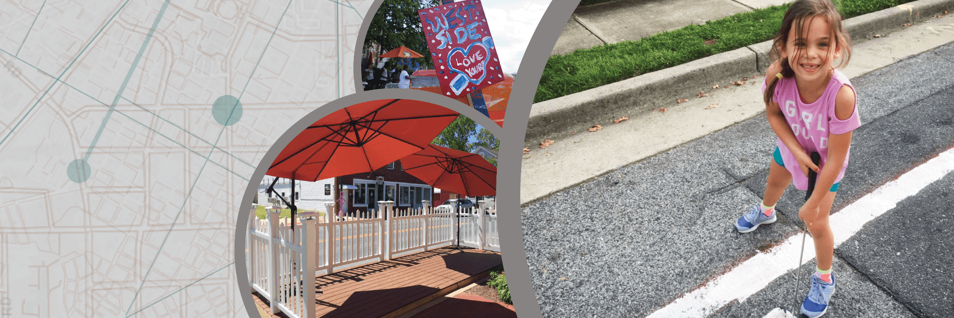
Explore the Stories of Delaware’s Complete Communities GIS story map to learn how communities are creating pop-ups for calmer traffic and resident engagement. Reconfiguring roadways and public spaces can help calm traffic and achieve more walkable-, bikeable-,...
by Sarah Marshall Pragg | Jul 1, 2016 | News, Toolbox
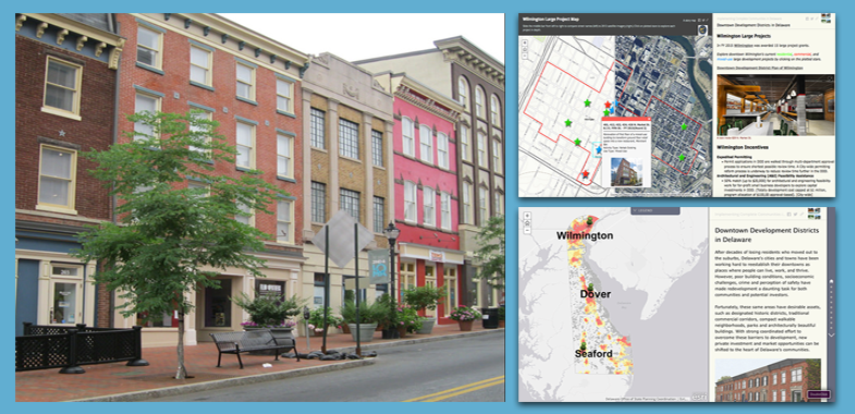
On June 27, Governor Jack Markell and the Delaware State Housing Authority announced that Wilmington, Dover, and Seaford will receive $4.5 million in grant funding for 11 downtown revitalization projects at part of Delaware’s Downtown Development Districts...
by Sarah Marshall Pragg | Nov 9, 2015 | News, Toolbox
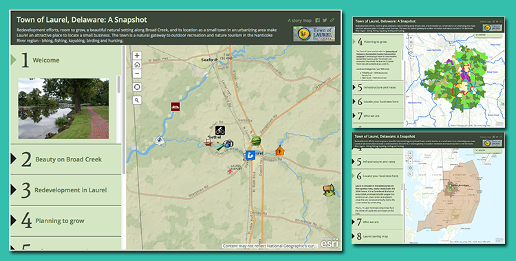
This GIS Story Map was developed for the Town of Laurel to highlight its outstanding redevelopment potential, location for small businesses, and quality of life. The GIS Story Map offers a variety of demographic and marketing data, points of interest, marketing...

by Sarah Marshall Pragg | Nov 6, 2014 | News, Toolbox
Received 10 Applications On November 1, 2014, 10 local governments submitted applications to be considered for designation as a Downtown Development District. Applications were received from Clayton, Dover, Middletown, Milford, Milton, New Castle County, Newark,...
by Sarah Marshall Pragg | Apr 5, 2012 | News
This new report by the MSU Land Policy Institute examines Michigan placemaking projects that attract growth through the education of relevant stakeholders, transformation of policies, removal of barriers and creation of incentives. The report also shares strategies...
