University of Delaware
Planning for Complete Communities in Delaware
  • Planning Your Community
    • Community Character
    • Demographics
    • Economic Development
    • Historic Preservation
    • Housing
    • Public Engagement
    • Sustainability
    • Transportation
  • Tools and Glossary
    • Glossary
    • Visual Tools
Select Page

The Benefits of GIS Story Maps

by Sarah Marshall Pragg | Aug 27, 2014 | News, Toolbox

Samples of Delaware GIS storymaps

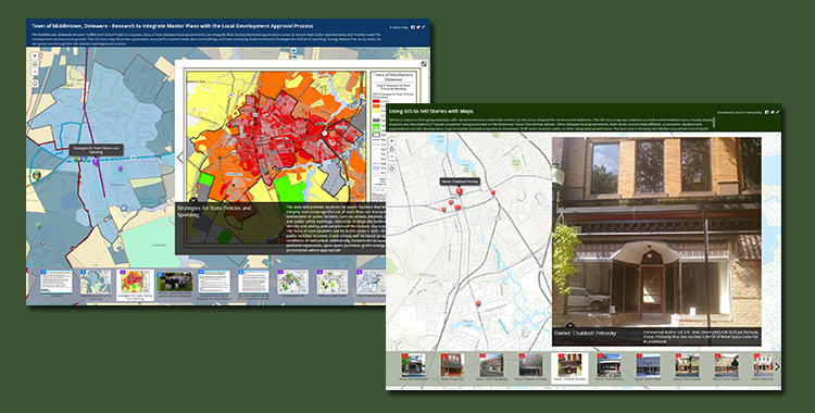
Story maps serve as a great visualization tool for communicating a story or sequential events through the use of photos, videos, and geospatial data; summarizing each step for managers, decision makers and the general public.

The new story maps section of the toolbox highlights two story maps in Delaware that promote local government initiatives to support market-ready (re)development.

Contact IPA’s GIS Specialist Nicole Minni, at nminni@udel.edu, to obtain information on contracting her services to develop story maps.

The Delaware Complete Communities Toolbox is a product of the Institute for Public Administration (IPA) at the University of Delaware, with support from the Delaware Department of Transportation.

This work is licensed under a Creative Commons Attribution NonCommercial 4.0 International License. If you have any questions about this policy, or wish to request permission for a use not covered by the CC BY-NC license, please contact ipa@udel.edu.