
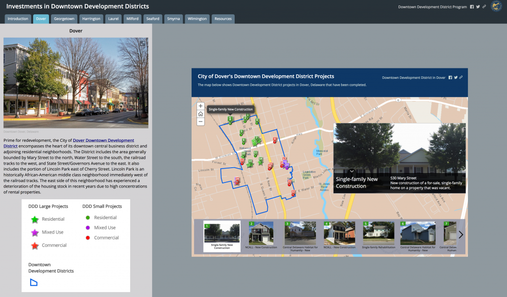
 The Investments in Downtown Development Districts (DDDs) GIS story map highlights developer investments for both large and small project set-asides in each DDD community through 2017. In addition, the map identifies the type of project in terms of commercial, residential, and/or mixed-use development. This story map is comprised of eight (8) individual story maps, one for each of Delaware’s designated DDDs, which may be viewed in the “Implementing Complete Communities in Delaware” GIS Story Map Gallery.
To learn more about using GIS story maps as a tool for public engagement, visit our GIS story maps page.